Air traffic control

Air traffic control (ATC) is a service provided by ground-based air traffic controllers who direct aircraft on the ground and through controlled airspace, and can provide advisory services to aircraft in non-controlled airspace. The primary purpose of ATC worldwide is to prevent collisions, organize and expedite the flow of air traffic, and provide information and other support for pilots. In some countries, ATC plays a security or defensive role, or is operated by the military.
To prevent collisions, ATC enforces traffic separation rules, which ensure each aircraft maintains a minimum amount of empty space around it at all times. Many aircraft also have collision avoidance systems, which provide additional safety by warning pilots when other aircraft get too close.
In many countries, ATC provides services to all private, military, and commercial aircraft operating within its airspace. Depending on the type of flight and the class of airspace, ATC may issue instructions that pilots are required to obey, or advisories (known as flight information in some countries) that pilots may, at their discretion, disregard. The pilot in command is the final authority for the safe operation of the aircraft and may, in an emergency, deviate from ATC instructions to the extent required to maintain safe operation of their aircraft.
Overview
The airspace is divided into flight information regions , known as FIR (from the English Flight Information Region ), and each country is responsible for the service in those included in its area of responsibility. In many cases this area of responsibility exceeds the territorial waters of a country, so that the airspace included over international watershave an information service. The airspace in which the air control service is provided is called controlled airspace and the unit in charge of providing it is called an area control center. Due to the large airspace they manage, they are divided into control sectors, each responsible for a part of the total space. When an airplane is about to leave one sector it is transferred to the next, and so on until landing at its destination. Currently, most of the air routes are covered by radars, which allows permanent tracking of flights.
In the flight information regions are the terminal areas of the important airports and between them the airways run through the corridors through which the aircraft circulate. Other elements are prohibited, restricted or dangerous areas, which are areas where the flight of aircraft is restricted in different measures and for different reasons.
The regulations that regulate air traffic in controlled airspace are included in the Air Traffic Regulation .
Language
Pursuant to requirements of the International Civil Aviation Organization (ICAO), ATC operations are conducted either in the English language or the language used by the station on the ground. In practice, the native language for a region is normally used; however, the English language must be used upon request.
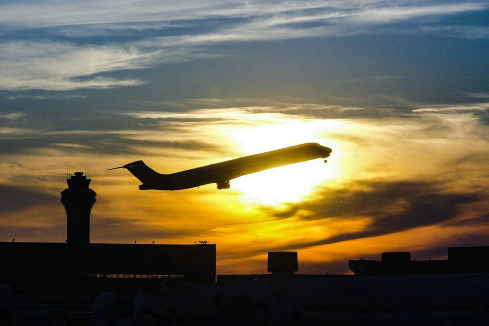
Air traffic control tower
The primary method of controlling the immediate airport environment is visual observation from the airport control tower. The tower is a tall, windowed structure located on the airport grounds. Air traffic controllers are responsible for the separation and efficient movement of aircraft and vehicles operating on the taxiways and runways of the airport itself, and aircraft in the air near the airport, generally 5 to 10 nautical miles (9 to 18 km) depending on the airport procedures.
Surveillance displays are also available to controllers at larger airports to assist with controlling air traffic. Controllers may use a radar system called secondary surveillance radar for airborne traffic approaching and departing. These displays include a map of the area, the position of various aircraft, and data tags that include aircraft identification, speed, altitude, and other information described in local procedures. In adverse weather conditions the tower controllers may also use surface movement radar (SMR), surface movement guidance and control systems (SMGCS) or advanced SMGCS to control traffic on the manoeuvring area (taxiways and runway).
The areas of responsibility for tower controllers fall into three general operational disciplines; local control or air control, ground control, and flight data / clearance delivery—other categories, such as Apron control or ground movement planner, may exist at extremely busy airports. While each tower may have unique airport-specific procedures, such as multiple teams of controllers (‘crews’) at major or complex airports with multiple runways, the following provides a general concept of the delegation of responsibilities within the tower environment.
Remote and virtual tower (RVT) is a system based on air traffic controllers being located somewhere other than at the local airport tower and still able to provide air traffic control services. Displays for the air traffic controllers may be live video, synthetic images based on surveillance sensor data, or both.
Ground control
Ground control (sometimes known as ground movement control) is responsible for the airport “movement” areas, as well as areas not released to the airlines or other users. This generally includes all taxiways, inactive runways, holding areas, and some transitional aprons or intersections where aircraft arrive, having vacated the runway or departure gate. Exact areas and control responsibilities are clearly defined in local documents and agreements at each airport. Any aircraft, vehicle, or person walking or working in these areas is required to have clearance from ground control. This is normally done via VHF/UHF radio, but there may be special cases where other procedures are used. Aircraft or vehicles without radios must respond to ATC instructions via aviation light signals or else be led by vehicles with radios. People working on the airport surface normally have a communications link through which they can communicate with ground control, commonly either by handheld radio or even cell phone. Ground control is vital to the smooth operation of the airport, because this position impacts the sequencing of departure aircraft, affecting the safety and efficiency of the airport’s operation.
Some busier airports have surface movement radar (SMR), such as, ASDE-3, AMASS or ASDE-X, designed to display aircraft and vehicles on the ground. These are used by ground control as an additional tool to control ground traffic, particularly at night or in poor visibility. There are a wide range of capabilities on these systems as they are being modernized. Older systems will display a map of the airport and the target. Newer systems include the capability to display higher quality mapping, radar target, data blocks, and safety alerts, and to interface with other systems such as digital flight strips.
Air control or local control
Air control (known to pilots as “tower” or “tower control”) is responsible for the active runway surfaces. Air control clears aircraft for takeoff or landing, ensuring that prescribed runway separation will exist at all times. If the air controller detects any unsafe conditions, a landing aircraft may be instructed to “go-around” and be re-sequenced into the landing pattern. This re-sequencing will depend on the type of flight and may be handled by the air controller, approach or terminal area controller.
Within the tower, a highly disciplined communications process between air control and ground control is an absolute necessity. Air control must ensure that ground control is aware of any operations that will impact the taxiways, and work with the approach radar controllers to create “gaps” in the arrival traffic to allow taxiing traffic to cross runways and to allow departing aircraft to take off. Ground control need to keep the air controllers aware of the traffic flow towards their runways in order to maximise runway utilisation through effective approach spacing. Crew resource management (CRM) procedures are often used to ensure this communication process is efficient and clear. Within ATC, it is usually known as TRM (Team Resource Management) and the level of focus on TRM varies within different ATC organisations.
Flight data and clearance delivery
Clearance delivery is the position that issues route clearances to aircraft, typically before they commence taxiing. These clearances contain details of the route that the aircraft is expected to fly after departure. Clearance delivery or, at busy airports, Ground Movement Planner (GMP) or Traffic Management Coordinator (TMC) will, if necessary, coordinate with the relevant radar centre or flow control unit to obtain releases for aircraft. At busy airports, these releases are often automatic and are controlled by local agreements allowing “free-flow” departures. When weather or extremely high demand for a certain airport or airspace becomes a factor, there may be ground “stops” (or “slot delays”) or re-routes may be necessary to ensure the system does not get overloaded. The primary responsibility of clearance delivery is to ensure that the aircraft have the correct aerodrome information, such as weather and airport conditions, the correct route after departure and time restrictions relating to that flight. This information is also coordinated with the relevant radar centre or flow control unit and ground control in order to ensure that the aircraft reaches the runway in time to meet the time restriction provided by the relevant unit. At some airports, clearance delivery also plans aircraft push-backs and engine starts, in which case it is known as the Ground Movement Planner (GMP): this position is particularly important at heavily congested airports to prevent taxiway and apron gridlock.
Flight data (which is routinely combined with clearance delivery) is the position that is responsible for ensuring that both controllers and pilots have the most current information: pertinent weather changes, outages, airport ground delays/ground stops, runway closures, etc. Flight data may inform the pilots using a recorded continuous loop on a specific frequency known as the automatic terminal information service (ATIS).
Approach and terminal control
Many airports have a radar control facility that is associated with the airport. In most countries, this is referred to as terminal control; in the U.S., it is referred to as a TRACON (terminal radar approach control). While every airport varies, terminal controllers usually handle traffic in a 30-to-50-nautical-mile (56 to 93 km) radius from the airport. Where there are many busy airports close together, one consolidated terminal control center may service all the airports. The airspace boundaries and altitudes assigned to a terminal control center, which vary widely from airport to airport, are based on factors such as traffic flows, neighboring airports and terrain. A large and complex example was the London Terminal Control Centre, which controlled traffic for five main London airports up to 20,000 feet (6,100 m) and out to 100 nautical miles (190 km).
Terminal controllers are responsible for providing all ATC services within their airspace. Traffic flow is broadly divided into departures, arrivals, and overflights. As aircraft move in and out of the terminal airspace, they are handed off to the next appropriate control facility (a control tower, an en-route control facility, or a bordering terminal or approach control). Terminal control is responsible for ensuring that aircraft are at an appropriate altitude when they are handed off, and that aircraft arrive at a suitable rate for landing.
Not all airports have a radar approach or terminal control available. In this case, the en-route center or a neighboring terminal or approach control may co-ordinate directly with the tower on the airport and vector inbound aircraft to a position from where they can land visually. At some of these airports, the tower may provide a non-radar procedural approach service to arriving aircraft handed over from a radar unit before they are visual to land. Some units also have a dedicated approach unit which can provide the procedural approach service either all the time or for any periods of radar outage for any reason.
In the U.S., TRACONs are additionally designated by a three-digit alphanumeric code. For example, the Chicago TRACON is designated C90.
En route, center, or area control
ATC provides services to aircraft in flight between airports as well. Pilots fly under one of two sets of rules for separation: visual flight rules (VFR) or instrument flight rules (IFR). Air traffic controllers have different responsibilities to aircraft operating under the different sets of rules. While IFR flights are under positive control, in the US VFR pilots can request flight following, which provides traffic advisory services on a time permitting basis and may also provide assistance in avoiding areas of weather and flight restrictions. Across Europe, pilots may request for a “Flight Information Service”, which is similar to flight following. In the UK it is known as a “traffic service”.
En-route air traffic controllers issue clearances and instructions for airborne aircraft, and pilots are required to comply with these instructions. En-route controllers also provide air traffic control services to many smaller airports around the country, including clearance off of the ground and clearance for approach to an airport. Controllers adhere to a set of separation standards that define the minimum distance allowed between aircraft. These distances vary depending on the equipment and procedures used in providing ATC services.
General characteristics
En-route air traffic controllers work in facilities called air traffic control centers, each of which is commonly referred to as a “center”. The United States uses the equivalent term air route traffic control center (ARTCC). Each center is responsible for many thousands of square miles of airspace (known as a flight information region) and for the airports within that airspace. Centers control IFR aircraft from the time they depart from an airport or terminal area’s airspace to the time they arrive at another airport or terminal area’s airspace. Centers may also “pick up” VFR aircraft that are already airborne and integrate them into the IFR system. These aircraft must, however, remain VFR until the center provides a clearance.
Center controllers are responsible for issuing instructions to pilots to climb their aircraft to their assigned altitude while, at the same time, ensuring that the aircraft is properly separated from all other aircraft in the immediate area. Additionally, the aircraft must be placed in a flow consistent with the aircraft’s route of flight. This effort is complicated by crossing traffic, severe weather, special missions that require large airspace allocations, and traffic density. When the aircraft approaches its destination, the center is responsible for issuing instructions to pilots so that they will meet altitude restrictions by specific points, as well as providing many destination airports with a traffic flow, which prohibits all of the arrivals being “bunched together”. These “flow restrictions” often begin in the middle of the route, as controllers will position aircraft landing in the same destination so that when the aircraft are close to their destination they are sequenced.
As an aircraft reaches the boundary of a center’s control area it is “handed off” or “handed over” to the next Area Control Center. In some cases this “hand-off” process involves a transfer of identification and details between controllers so that air traffic control services can be provided in a seamless manner; in other cases local agreements may allow “silent handovers” such that the receiving center does not require any co-ordination if traffic is presented in an agreed manner. After the hand-off, the aircraft is given a frequency change and begins talking to the next controller. This process continues until the aircraft is handed off to a terminal controller (“approach”).
Radar coverage
Since centers control a large airspace area, they will typically use long range radar that has the capability, at higher altitudes, to see aircraft within 200 nautical miles (370 km) of the radar antenna. They may also use TRACON radar data to control when it provides a better “picture” of the traffic or when it can fill in a portion of the area not covered by the long range radar.
In the U.S. system, at higher altitudes, over 90% of the U.S. airspace is covered by radar and often by multiple radar systems; however, coverage may be inconsistent at lower altitudes used by unpressurized aircraft due to high terrain or distance from radar facilities. A center may require numerous radar systems to cover the airspace assigned to them, and may also rely on pilot position reports from aircraft flying below the floor of radar coverage. This results in a large amount of data being available to the controller. To address this, automation systems have been designed that consolidate the radar data for the controller. This consolidation includes eliminating duplicate radar returns, ensuring the best radar for each geographical area is providing the data, and displaying the data in an effective format.
Unmanned radar on a remote mountain
Centers also exercise control over traffic travelling over the world’s ocean areas. These areas are also flight information regions (FIRs). Because there are no radar systems available for oceanic control, oceanic controllers provide ATC services using procedural control. These procedures use aircraft position reports, time, altitude, distance, and speed to ensure separation. Controllers record information on flight progress strips and in specially developed oceanic computer systems as aircraft report positions. This process requires that aircraft be separated by greater distances, which reduces the overall capacity for any given route. See for example the North Atlantic Track system.
Flight traffic mapping
The mapping of flights in real-time is based on the air traffic control system. In 1991, data on the location of aircraft was made available by the Federal Aviation Administration to the airline industry. The National Business Aviation Association (NBAA), the General Aviation Manufacturers Association, the Aircraft Owners and Pilots Association, the Helicopter Association International, and the National Air Transportation Association petitioned the FAA to make ASDI information available on a “need-to-know” basis. Subsequently, NBAA advocated the broad-scale dissemination of air traffic data. The Aircraft Situational Display to Industry (ASDI) system now conveys up-to-date flight information to the airline industry and the public. Some companies that distribute ASDI information are FlightExplorer, FlightView, and FlyteComm. Each company maintains a website that provides free updated information to the public on flight status. Stand-alone programs are also available for displaying the geographic location of airborne IFR (instrument flight rules) air traffic anywhere in the FAA air traffic system. Positions are reported for both commercial and general aviation traffic. The programs can overlay air traffic with a wide selection of maps such as, geo-political boundaries, air traffic control center boundaries, high altitude jet routes, satellite cloud & radar imagery.
Problems
Traffic
The day-to-day problems faced by the air traffic control system are primarily related to the volume of air traffic demand placed on the system and weather. Several factors dictate the amount of traffic that can land at an airport in a given amount of time. Each landing aircraft must touch down, slow, and exit the runway before the next crosses the approach end of the runway. This process requires at least one and up to four minutes for each aircraft. Allowing for departures between arrivals, each runway can thus handle about 30 arrivals per hour. A large airport with two arrival runways can handle about 60 arrivals per hour in good weather. Problems begin when airlines schedule more arrivals into an airport than can be physically handled, or when delays elsewhere cause groups of aircraft – that would otherwise be separated in time – to arrive simultaneously. Aircraft must then be delayed in the air by holding over specified locations until they may be safely sequenced to the runway. Up until the 1990s, holding, which has significant environmental and cost implications, was a routine occurrence at many airports. Advances in computers now allow the sequencing of planes hours in advance. Thus, planes may be delayed before they even take off (by being given a “slot”), or may reduce speed in flight and proceed more slowly thus significantly reducing the amount of holding.
Air traffic control errors occur when the separation (either vertical or horizontal) between airborne aircraft falls below the minimum prescribed separation set (for the domestic United States) by the US Federal Aviation Administration. Separation minimums for terminal control areas (TCAs) around airports are lower than en-route standards. Errors generally occur during periods following times of intense activity, when controllers tend to relax and overlook the presence of traffic and conditions that lead to loss of minimum separation.
Weather
Beyond runway capacity issues, the weather is a major factor in traffic capacity. Rain, ice, snow or hail on the runway cause landing aircraft to take longer to slow and exit, thus reducing the safe arrival rate and requiring more space between landing aircraft. Fog also requires a decrease in the landing rate. These, in turn, increase airborne delay for holding aircraft. If more aircraft are scheduled than can be safely and efficiently held in the air, a ground delay program may be established, delaying aircraft on the ground before departure due to conditions at the arrival airport.
In Area Control Centers, a major weather problem is thunderstorms, which present a variety of hazards to aircraft. Aircraft will deviate around storms, reducing the capacity of the en-route system by requiring more space per aircraft or causing congestion as many aircraft try to move through a single hole in a line of thunderstorms. Occasionally weather considerations cause delays to aircraft prior to their departure as routes are closed by thunderstorms.
Callsigns
A prerequisite to safe air traffic separation is the assignment and use of distinctive call signs. These are permanently allocated by ICAO on request usually to scheduled flights and some air forces and other military services for military flights. They are written callsigns with a 3-letter combination like KLM, BAW, VLG followed by the flight number, like AAL872, VLG1011. As such they appear on flight plans and ATC radar labels. There are also the audio or Radiotelephony callsigns used on the radio contact between pilots and air traffic control. These are not always identical to their written counterparts. An example of an audio callsign would be “Speedbird 832”, instead of the written “BAW832”. This is used to reduce the chance of confusion between ATC and the aircraft. By default, the callsign for any other flight is the registration number (tail number) of the aircraft, such as “N12345”, “C-GABC” or “EC-IZD”. The short Radiotelephony callsigns for these tail numbers is the last 3 letters using the NATO phonetic alphabet (i.e. ABC spoken alpha-bravo-charlie for C-GABC) or the last 3 numbers (i.e. three-four-five for N12345). In the United States, the prefix may be an aircraft type, model or manufacturer in place of the first registration character, for example, “N11842” could become “Cessna 842”. This abbreviation is only allowed after communications have been established in each sector.
Technology
Many technologies are used in air traffic control systems. Primary and secondary radar are used to enhance a controller’s situation awareness within his assigned airspace – all types of aircraft send back primary echoes of varying sizes to controllers’ screens as radar energy is bounced off their skins, and transponder-equipped aircraft reply to secondary radar interrogations by giving an ID (Mode A), an altitude (Mode C) and/or a unique callsign (Mode S). Certain types of weather may also register on the radar screen.
These inputs, added to data from other radars, are correlated to build the air situation. Some basic processing occurs on the radar tracks, such as calculating ground speed and magnetic headings.
Usually, a flight data processing system manages all the flight plan related data, incorporating – in a low or high degree – the information of the track once the correlation between them (flight plan and track) is established. All this information is distributed to modern operational display systems, making it available to controllers.
The FAA has spent over US$3 billion on software, but a fully automated system is still over the horizon. In 2002 the UK brought a new area control centre into service at the London Area Control Centre, Swanwick, Hampshire, relieving a busy suburban centre at West Drayton, Middlesex, north of London Heathrow Airport. Software from Lockheed-Martin predominates at the London Area Control Centre. However, the centre was initially troubled by software and communications problems causing delays and occasional shutdowns.
Screen content recording: Hardware or software based recording function which is part of most modern automation system and that captures the screen content shown to the ATCO. Such recordings are used for a later replay together with audio recording for investigations and post event analysis.
Communication navigation surveillance / air traffic management (CNS/ATM) systems are communications, navigation, and surveillance systems, employing digital technologies, including satellite systems together with various levels of automation, applied in support of a seamless global air traffic management system.
Proposed changes
In the United States, some alterations to traffic control procedures are being examined.
The Next Generation Air Transportation System examines how to overhaul the United States national airspace system.
Free flight is a developing air traffic control method that uses no centralized control (e.g. air traffic controllers). Instead, parts of airspace are reserved dynamically and automatically in a distributed way using computer communication to ensure the required separation between aircraft.
In Europe, the SESAR (Single European Sky ATM Research) programme plans to develop new methods, technologies, procedures, and systems to accommodate future (2020 and beyond) air traffic needs.
Change in regulation in admittance for possible A.T.C.’s regarding their eye-refraction and correction thereof by technology has been proposed.
Privatization
Many countries have also privatized or corporatized their air navigation service providers. There are several models that can be used for ATC service providers. The first is to have the ATC services be part of a government agency as is currently the case in the United States. The problem with this model is that funding can be inconsistent and can disrupt the development and operation of services. Sometimes funding can disappear when lawmakers cannot approve budgets in time. Both proponents and opponents of privatization recognize that stable funding is one of the major factors for successful upgrades of ATC infrastructure. Some of the funding issues include sequestration and politicization of projects. Proponents argue that moving ATC services to a private corporation could stabilize funding over the long term which will result in more predictable planning and rollout of new technology as well as training of personnel.
Another model is to have ATC services provided by a government corporation. This model is used in Germany, where funding is obtained through user fees. Yet another model is to have a for-profit corporation operate ATC services. This is the model used in the United Kingdom, but there have been several issues with the system there including a large-scale failure in December 2014 which caused delays and cancellations and has been attributed to cost-cutting measures put in place by this corporation. In fact, earlier that year, the corporation owned by the German government won the bid to provide ATC services for Gatwick Airport in the United Kingdom. The last model, which is often the suggested model for the United States to transition to is to have a non-profit organization that would handle ATC services as is used in Canada.
The Canadian system is the one most often used as a model by proponents of privatization. Air traffic control privatization has been successful in Canada with the creation of Nav Canada, a private nonprofit organization which has reduced costs and has allowed new technologies to be deployed faster due to the elimination of much of the bureaucratic red tape. This has resulted in shorter flights and less fuel usage. It has also resulted in flights being safer due to new technology. Nav Canada is funded from fees that are collected from the airlines based on the weight of the aircraft and the distance flown.
ATC regulations in the United States
FAA control tower operators (CTO) / air traffic controllers use FAA Order 7110.65 as the authority for all procedures regarding air traffic. For more information regarding air traffic control rules and regulations, refer to the FAA’s website.
Source from Wikipedia