Six-Fours-les-Plages is a French commune located at the edge of the Mediterranean in the department of Var, in the region Provence-Alpes-Côte d’Azur. It is part of the Toulon Provence Mediterranean metropolis. Its territory, geographically privileged although subject to an important mistral, is characterized by an important wooded part and an urbanization concentrated on the coast and around the fort of Six-Fours. The latter is located on a remarkable hill and protects the harbor of Toulon, which the town surrounds.
The city offers several points of interest. The fort on the hill that dominates the city neighbours an eleventh-century chapel, St Peter “collégiale”. There are also nice beaches from the very popular “brutal beach”, famous for windsurfing to the secret cove in the Sicié massif. The Île des Embiez is the site of an oceanographic research centre, and the smaller Île Gaou is where concerts are organised every summer.
Geography
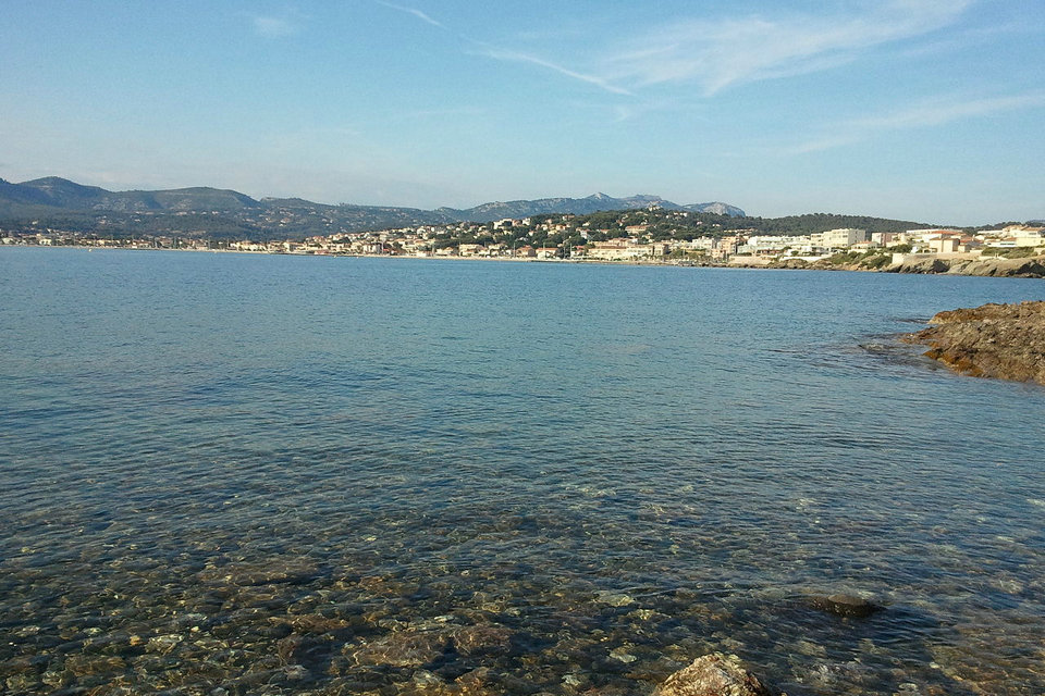
Six-Fours is located between the municipalities of Ollioules, Sanary-sur-Mer and La Seyne-sur-Mer. It forms with La Seyne-sur-Mer and Saint-Mandrier a peninsula advancing in the Mediterranean Sea and protecting the harbor of Toulon. The protection offered at the naval base explains the numerous military works present in the town (Fort de Six-Fours, batteries of Cap Nègre and Cap Sicié). Its coast is exposed to the west, making it very sensitive to Mistral episodes whose gusts can easily exceed 100 km / h during the most violent. The Embiez and Gaou islands mark the southwest end of the town and constitute precious natural reserves and a popular tourist destination. The Cape Sicié forms the southern tip of the municipality,
History
From a simple hamlet located on the hill of the fort and surrounded by an imposing wall made up of several towers (hence its toponymy), the town saw its population increase from the 1960s as tourism and tourism developed. subsequent urbanization. Today it is both a residential suburb of Toulon and a seaside resort appreciated for its natural heritage.
Greco-Roman period
The most significant traces of the Greco-Roman era have been unearthed in the locality: the Citadel, in the hamlet of Brusc. This place, which overlooks the port of Brusc, has been over-urbanized since the Second World War. You could still see the remains of fortifications (a solid wall over a meter thick). Massaliote, Greek and Roman coins were found there, but also bronze objects, sigillated ceramics, glass, bone, millstones of arm mills in basalt and objects in iron and lead.
In 1953, we discovered, by chance, an underground gallery under the road to the Citadel. They are actually the foundations of an aqueduct which probably supplied Le Brusc with drinking water and supplied the ships. The construction of this building can only be attributed to the Greeks of the Massaliote colony. Other objects found during the surrounding excavations testify to the important activity of this Greek colony.
Tauroies – Tauroentium: the position of this Marseille Marseille colony has been the subject of various quarrels between archaeologists. However, the underwater discoveries prove that it was well located in Brusc. Marseilles having allied with Pompée during the first civil war, César made the seat of it and took it in 49 av. In retaliation, the citadel of Tauroentium was destroyed.
The strategic importance of this advanced post in Marseille is therefore well justified. It remains however to highlight the Acropolis (place of sacred fire and sacrifices) since the foundation of a Greek colony was done according to a precise religious rite. Unfortunately, no trace has been highlighted. The aqueduct remains buried and is only visible when passing through a cafe.
Gallo-Roman civilization: very many discoveries (debris of mosaics, tombs with tiles, red sigillated pottery, Campanian ceramics, millstones, glass vials…) were made on the dwellings on Six-Fours: the Orchard, the Crottes, Lerys, Petugue, Sauviou, Playes (large Gallo-Roman village), Calade, Pépiole (near the chapel).
Due to the profusion of constructions, much research and traces of the past are likely to remain forever in the ground. But these discoveries at the beginning of xx th century are nevertheless significant from the Gallo-Roman activity.
Middle Ages
Gaul early in the iv th century witnessed an important religious development. Thirty bishoprics in 313, and around 360 on the Mediterranean coasts the convents were built. Thus the Roman influence subsides and gives way to a Christian world. Note that the first bishops of Toulon, are Augustal between 441 and 450 and Honoré existed in 450. The Visigoths (in 412) made incursions to Provence, then the Ostrogoths and the Franks.
In this region, an original civilization mixing Roman traditions and the customs of the Nordic invaders was gradually created. But the use of Latin is lost, religious power degrades misery and savagery increase. Provence, from 771, is included in the Holy Roman Empire, and remain linked to the xiv th century.
The death of Queen Jeanne I opened a crisis of succession to head the county of Provence, the cities of Aix Union (1382-1387) supporting Charles of Durazzo against Louis I of Anjou. The community of Six-Fours supports Duras until 1386, then changed sides to join the Angevin through patient negotiation of Marie de Blois, widow of Louis I and regent of their son Louis II. The surrender of Aix could also play a role in the community’s about-face.
Tourism
In Provence, at the edge of the Mediterranean, Six Fours les Plages, tourist town, sporting and seaside destination, welcomes you throughout the year.
From the tip of Cap Nègre, passing through the peninsula of Gaou to the exceptional site of the preserved forest of Cap Sicié. Come and discover 19 km of coastline alternating beaches, secret coves for the happiness of all. To take full advantage of these magnificent panoramas, get into the water (paddle, windsurfing, jet…) or underwater (scuba diving) safely.
From the Brusc embark on a paradise archipelago, the famous island of Paul Ricard: Les Embiez, nicknamed the island of flowers, the island is also known for its action concerning the protection of the marine environment.
History lovers will be seduced by the collegiate church of Saint Pierre, the only vestige of the feudal village of Six Fours, by the chapel of Pepiole in its case of olive trees and vines and by the chapel of Notre Dame du Mai overlooking and dominating the massif of the Cap Sicié. Six Fours which has long lived to the rhythm of its 120 hamlets, welcomes you today through its Provencal markets and its many events including the bouillabaisse festival which takes place on the picturesque Port du Brusc and its peaks.
Six Fours is also a leisure destination where you can practice many family activities, between sea and forest (adventure park in the trees, biking, horse riding…).
Culture heritage
Chapel of Our Lady of Pepiole
Pre-Romanesque chapel with 3 naves and absidioles, restored in 1956 by Father Charlier.
Chapel of Our Lady of May
Chapel object of pilgrimages built in 1625. Impressive view of the open sea and the coast.
Saint Pierre du Brusc Church
Built on the initiative of Jules de Greling in 1873 and completed in 1874. The Landowski family painted the choir’s fresco there in 1942, the Stations of the Cross in 1960 and the stained glass windows in 1973.
Paul Ricard Oceanographic Institute
The mission of the Paul Ricard Oceanographic Institute is to contribute to the knowledge and protection of the marine environment in the Mediterranean. The museum supports awareness-raising actions…
Collegiate Church of Saint Pierre
This listed historic monument is located 210 meters at the top of the hill of Vieux Six Fours. Romanesque part of the 11th century, 13th century bell tower and Gothic extension in 1608.
Sainte Cécile Chapel
The Sainte Cécile chapel, in Romanesque style, was inaugurated by Paul Ricard on July 16, 1992.
Cap Nègre Battery
The 1st battery was reorganized under Louis Philippe 1er (1846 -50). Exhibition’s venue.
Civil architectural heritage
The villa Cécile, private property closed to the public, which was part in the xvii th century of a wider domain regrouping agricultural land and woods and which belonged to the brotherhood Su Saint Esperit. The architecture of the mansion is of Italian inspiration. In the remarkable botanical park which surrounds the property, rare palm trees are cultivated, in particular archontophoenix. A tèse, or ladies’ hunt, still exists in the park.
The villa Saint Ange (1933), route de la Lecque, built by the architect Barry Dierks on a commission from Hedwige d’Ursel. Member of the Belgian high aristocracy, protector of the royal children Albert and Baudouin during the Occupation, intimate of many crowned heads of Europe, Hedwig of Ursel, countess of the Holy Empire will invite the ex-empress of Austria and her children to spend the summer of 1937 in his home. Private property closed to the public.
The Grand Rouveau lighthouse.
The transmitter of Cape Sicié with a radio tower 82 meters high.
Military Heritage
Built in the xix th century, the Fort of Six-Fours (alt. 210 m) dominates the town. It is used as a military listening center for the Mediterranean area and as an operations center for the Naval Air Force.
The Cap Nègre battery, built between 1846 and 1850.
The blockhouses dating from the Second World War are found all along the coast (from Cape Sicié to Brusc in particular) and to the west of the fort of Six-Fours (military terrain, restricted access).
Religious heritage
The chapel of Notre-Dame de la Pépiole. This chapel, made up of pink, yellow and gray stones, two charming bell towers and three “absidioles”, is in the middle of a marvelous site: a landscape made up of pines, cypresses, olive trees, vines and broom against the background of the Toulon mountain. Its three primitive Romanesque chapels, originally independent, were reorganized into a single place of worship by the piercing of large side arches of blue stone. Inside statue of the xvii th century Our Lady of Pépiole. This small rural chapel depended on the bishopric of Toulon before being integrated into the terroir of Six-Fours. It dates from the 5th or 6th century (Merovingian period), making it one of the Christian buildings still standing among the oldest in France. It was enlarged in the 11th or 12th century.
The collegiate church of Saint-Pierre, adjacent to the fort of Six-Fours, consists of an original Romanesque building from the xii th century which was enlarged in the early xvii th century by a Gothic building. From its location, one has an extraordinary panorama on the harbors of Toulon and Sanary. This church belonged a long time to the abbey of Montmajour, then passed to the monastery of Saint-Victor of Marseille. One notices a dozen paintings, including a triptych, a magnificent polyptych attributed to Louis Brea and “Descent from the Cross” of the Flemish school (end of the xvi th). It also houses several statues, including a very beautiful statue of the Virgin (but falsely attributed to Pierre Puget). The church is the subject of historiographical argument: according to the most frequent work the church was built on a primitive church of v th or vi th century (itself perhaps sitting on the ruins ‘a Greco-Roman temple). Others refute these origins and stick to a first Romanesque church of the twelfth century (see Bibliography. Western Heritage Notebook Var n o 11 (2007) and n o 13 (2010)).
The Notre-Dame-du-Mai chapel, built in recognition of guards spared from lightning in 1625 in their Watchtower. The choir of the Notre-Dame-de-Bonne-Garde chapel, which overlooks Cape Sicié, is located in the town of Six-Fours (the rest of the building is located in the town of La Seyne-sur-Mer).
Environmental heritage
Cap Sicié, west which found the Embiez archipelago and the fishing village of Brusc, and east La Seyne-sur-Mer. This advance into the sea is renowned for its wild aspect and its maritime environment. On its summit is erected (at 357 m) the chapel of Notre-Dame-du-Mai, or the Guard; it shelters many ex-votos, in recognition for the lives of the sailors spared by the sea.
The Brusc lagoon, classified as a Natura 2000 area.
Cap Nègre and the Mediterranean park built on part of it.
Cape Sicé Massif
Mediterranean forest on shale soil (peak at 350m) managed by the National Office of Forests, extending between Brusc (Six Fours) and Fabrégas (La Seyne) of 1600 ha To discover especially in spring and autumn. Many plant species, some protected: cysts, cork oaks, broom, Aleppo pines, junipers… There are many hiking trails, do not hesitate to get IGN maps (on sale in our reception) or topo guides (on sale at the usual points of sale).
Viewpoint Of Collegiale Saint Pierre
Nestled at the top of the hill of Vieux Six Fours, the Saint Pierre collegiate church is a listed monument dating from the Romanesque period. It thus benefits from an exceptional panorama which sweeps the town of Six Fours up to the harbor of Toulon.
The Islands
The Embiez archipelago is now well known to the general public thanks to its founder Paul Ricard. The Isle of Embiez is also called “The Isle of Flowers”. A little paradise on earth.
The islands of Petit and Grand Gaou often simply called “le Gaou” are very popular with locals and tourists who like to go there for a picnic with family or friends, or play a game of pétanque under the pines.
Gaou Island
The islands of Petit and Grand Gaou often simply called “le Gaou”. The island of Gaou, is located in the extension of the port of Brusc, opposite the island of Embiez. This little paradise is accessible by a walkway. It is very popular with locals and tourists who like to go there for a picnic with family or friends, or play a game of pétanque under the pines. These famous wind-sculpted pines known as anemomorphic pines.
Small corner under the trees, small beaches, large spaces for playing ball, the peninsula is quite varied and everyone finds pleasure there. In bad weather, Gaou even has a little resemblance to Brittany, and that is not to displease us.
The coast facing the sea presents small cut cliffs and turquoise water. it is good to land on the benches to admire the landscape, the sunset or take photos. It is possible to swim on the part of the island that faces the Embiez. The water is shallow and therefore ideal for families.
The Festival des Voix Du Gaou, a contemporary outdoor music festival where great international stars have performed, was held there a short time ago. Recently, the Pointu Festival has been meeting music and place lovers in July. This festival is free and offers, as its name suggests, an advanced indie / rock program.
It’s maritime surface is located in the extension of the port of Brusc to the island of Gaou. The water is calm like a lake and shallow. This natural environment is doubly protected by the Natura 2000 area and the Conservatoire du Littoral. The lagoon is a breeding ground for species, a nursery for fish and is home to a diverse marine flora including the Posidonia herbarium. This area is therefore prohibited for motor navigation, anchoring, trampling and the practice of windsurfing.
The Embiez Island
An island to dream, an island to escape… The Embiez archipelago includes the Embiez island, the Petit and Grand Rouveau islands and the Magnons rocks.
Embiez Island, an island for dreaming: getting away from it all, resting, feasting, having fun, getting together, Les Embiez is a la carte. With 90% of natural Mediterranean species, the Embiez island is rich in abundant flora and fauna. Its wild side is both the most surprising and the most appreciated: secret coves, reefs, pine forest and scrubland, flowers and vines. On foot, by bike or on the little train, the spectacular views of the island and its natural diversity are a unique experience… Site of international reputation for boaters, divers and lovers of the sea, the island is also known for its Paul Ricard Oceanographic Institute which houses an aquarium.
Preserved from concrete, favoring soft travel modes, the island is a true haven of greenery and wild coves sheltering 90% of Mediterranean plant species and is a refuge for birds. The Embiez archipelago classified Natura 2000 area. The Natura 2000 network is a set of natural European sites, terrestrial and marine, identified for the scarcity or the fragility of wild species, animal or plant, and their habitats. Natura 2000 reconciles nature conservation and socio-economic concerns. In France, the Natura 2000 network includes 1,758 sites.
The Two Brothers
The 2 brothers are twin rocks in the shape of a sugar loaf located east of Cap Sicié. With an astonishing presence, they are the source of many legends that still haunt the waves… This is “the story”: 2 brothers found an injured mermaid one evening on the beach… They treated her and fell madly in love. In their madness, they killed each other. The siren, before regaining the waves, begged Poseidon to leave them an apparent shape in memory of their passion. The God of the Sea erected the 2 rocks there.
Beaches
Gaou coves
Paradise sandy coves and gravel accessible by a pedestrian walkway in the extension of the port of Brusc. The water is crystal clear and it is nice to put yourself in the shade of anemomorphic pines.
Coucoussa Creek
At the foot of the Coucoussa hill where the Marine Tower stands, a small pebble beach with crystal clear water, well protected from the wind, a little steep access. Magnificent panorama of the open sea and the coast.
Rix Beach
Wild cove with clear waters. Sports access, very steep path.
Croisette Cove
To the left of Gabrielle beach, a succession of coves and wild gravel beaches offering a superb view of the island of Grand Rouveau.
Germans Beach
Sand and crystal clear waters are at the rendezvous on the largest beach of the island of Embiez which is protected from the wind and whose access is easy by a small path. Magnificent view of Rouveau Island.
La Gabrielle Beach
Small wild beach with emerald water. Access by a steep path.
Saint Pierre Beach
You reach this pretty little pebble cove by a stony path. Swim at your own risk.
Petit Rouveau Beach
Very small gravel beach. Access is difficult, you have to trudge a little but your efforts will be rewarded by the beauty of the site.
Salins Beach
Small narrow sandy beach on the right when arriving from the port.
Grand Rouveau Beach
Small gravel beach next to the dock.
Charmettes Beach
Very small pebble beach in the extension of the Cros beach, very popular in summer and appreciated by windsurfers in case of mistral. Nearby, you will have the opportunity to practice water sports: windsurfing, stand up paddle, kayak…, and to eat in establishments located on the beach or on the port of Brusc.
Cros Beach
600 meters from the small port of Brusc, sandy beach, along the Cros ledge, near the road but a magnificent view of the Embiez island.
Rayolet Beach
This language of narrow sandy beach located between two points is accessible by the authorized paths of the Rayolet district, it is necessary to park along the road in direction of Brusc a few hundred meters after the beach of La Coudoulière.
La Coudoulière Beach
Succession of small coves then a large sandy cove away from traffic in the direction of Brusc. Very family-friendly beach located near tourist residences, shops, restaurants and leisure.
Roches Brunes Beach
Small gravel beach located after Cap Nègre in the direction of Brusc, ideal for families with children and water sports (jet-skiing, diving, boat rental, windsurfing). Paid parking, first aid station.
Cap Nègre Coves
Small wild coves with pleasant seabed along the coastal path. Accessible on foot from the Mediterranean port or from a pedestrian path that descends from the Corniche de Solviou.
Bonnegrace Beach
This large gravel beach is the largest of Six Fours. It measures approximately 1.2km and is located along the Charles de Gaulle promenade. There are many restaurants and beach establishments for renting mattresses and parasols. This beach is monitored during the tourist season from May to the end of September and a space is set up for swimming between the dikes. At the end of the beach towards La Coudoulière is a part of the beach called Brutal Beach. It is the meeting place for surfers and windsurfers, who in the event of a mistral wind benefit from the generous waves.
Frégate Beach
Continuing from the beach of Bonnegrace La Frégate is located on the edge of Sanary. It is a small quiet beach ideal for families, the sand allowing children to build many sandcastles.
French Riviera
The French Riviera is the Mediterranean coastline of the southeast corner of France. There is no official boundary, but it is usually considered to extend from Cassis, Toulon or Saint-Tropez on the west to Menton at the France–Italy border in the east, where the Italian Riviera joins. The coast is entirely within the Provence-Alpes-Côte d’Azur region of France. The Principality of Monaco is a semi-enclave within the region, surrounded on three sides by France and fronting the Mediterranean. Riviera is an Italian word that corresponds to the ancient Ligurian territory, wedged between the Var and Magra rivers.
The climate of the Côte d’Azur is temperate Mediterranean with mountain influences on the northern parts of the departments of Var and Alpes-Maritimes. It is characterized by dry summers and mild winters which help reduce the likelihood of freezing. The Côte d’Azur enjoys significant sunshine in mainland France for 300 days a year.
This coastline was one of the first modern resort areas. It began as a winter health resort for the British upper class at the end of the 18th century. With the arrival of the railway in the mid-19th century, it became the playground and vacation spot of British, Russian, and other aristocrats, such as Queen Victoria, Tsar Alexander II and King Edward VII, when he was Prince of Wales. In the summer, it also played home to many members of the Rothschild family. In the first half of the 20th century, it was frequented by artists and writers, including Pablo Picasso, Henri Matisse, Francis Bacon,h Wharton, Somerset Maugham and Aldous Huxley, as well as wealthy Americans and Europeans. After World War II, it became a popular tourist destination and convention site. Many celebrities, such as Elton John and Brigitte Bardot, have homes in the region.
The eastern part (maralpine) of the Côte d’Azur has been largely transformed by the concreting of the coast linked to the tourist development of foreigners from North Europe and the French,. The Var part is better preserved from urbanization with the exception of the agglomeration of Fréjus-Saint-Raphaël affected by the demographic growth of the maralpin coast and the agglomeration of Toulon which has been marked by urban sprawl on its part West and by a spread of industrial and commercial areas (Grand Var).