According to Japan Statistical Yearbook 2015, Japan in April 2012 had approximately 1,215,000 km of roads made up of 1,022,000 km of city, town and village roads, 129,000 km of prefectural roads, 55,000 km of general national highways and 8,050 km of national expressways. The Foreign Press Center/Japan cites a total length of expressways at 7,641 km (fiscal 2008). A single network of high-speed, divided, limited-access toll roads connects major cities on Honshu, Shikoku and Kyushu. Hokkaido has a separate network, and Okinawa Island has a highway of this type. In the year 2005, the toll collecting companies, formerly Japan Highway Public Corporation, have been transformed into private companies in public ownership, and there are plans to sell parts of them. The aim of this policy is to encourage competition and decrease tolls.
Road passenger and freight transport expanded considerably during the 1980s as private ownership of motor vehicles greatly increased along with the quality and extent of the nation’s roads. Bus companies including the JR Bus companies operate long-distance bus services on the nation’s expanding expressway network. In addition to relatively low fares and deluxe seating, the buses are well utilised because they continue service during the night, when air and train services are limited.
The cargo sector grew rapidly in the 1980s, recording 274.2 billion tonne-kilometres in 1990. The freight handled by motor vehicles, mainly trucks, in 1990, was over 6 billion tonnes, accounting for 90 percent of domestic freight tonnage and about 50 percent of tonne-kilometres.
Recent large infrastructure projects were the construction of the Great Seto Bridge and the Tokyo Bay Aqua-Line (opened 1997).
Although road fatalities have been decreasing, due in part to stricter enforcement of drunk driving laws, 2004 still saw 7,358 deaths on Japanese roads.
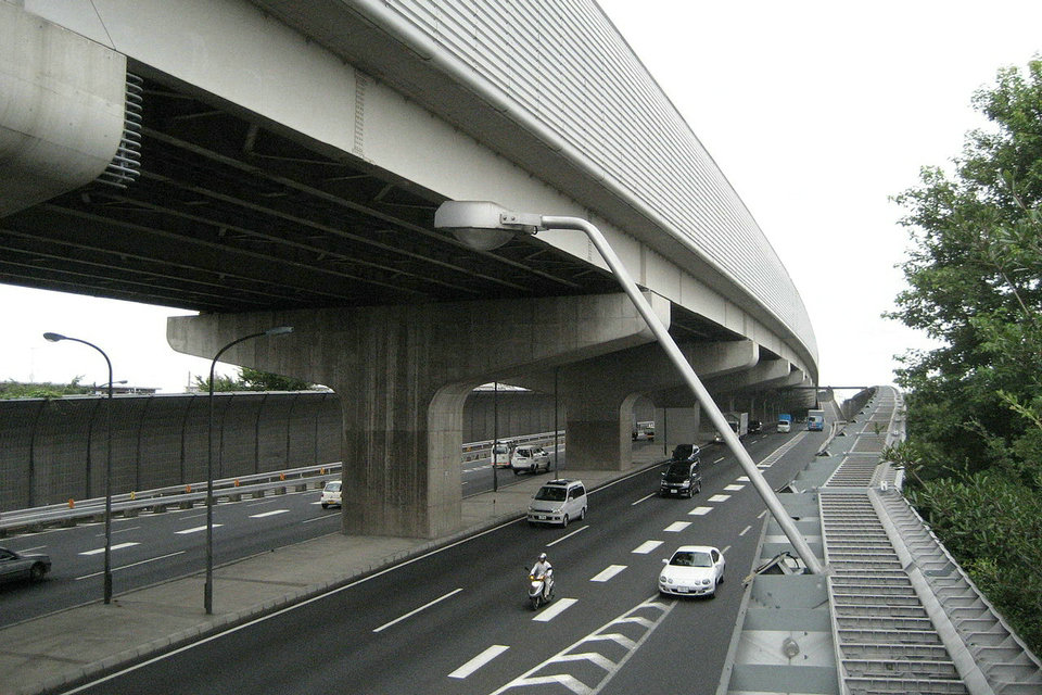
Japanese road
In the Road Law, only the national highway (general national highway and highway car national highway), prefectural road, municipal road (including special ward road) is regarded as “road”, but in general other things are also called “road”. Roads not dependent on the provisions of the Road Act include the following.
Road (Urban Planned Road) by Urban Planning Law (However, all of them are roads by road law)
Auto Road by Road Transport Law (General Expressway / Private Expressway)
Land Improvement Law · Agricultural Land Development Agricultural Road by the Public Corporation Act (Agricultural Exclusion Road, Regional Farm Road)
Forest Law · Forestry Basic Law · Forest Development Authority Law
Fishing port facility road / fishing exclusion road by fishing port fishing ground maintenance law (old name · fishing port law) (fishing exclusion road becomes road on road law after completion)
Lingang Road by the Port Act
Mining law · Roads due to security rules such as metal mining
Park road by natural park law, natural research road, long distance walk
Park under the Urban Park Law
Satomi by State-owned Property Law (For owners who have a function currently, transfer ownership to municipalities by April 1, 2005)
Private road (including “Position designated road” as stipulated in Article 42, Paragraph 1, Item 5 of the Building Standard Law)
The provisions of the Road Traffic Act and Road Trucking Vehicle Act apply to all roads used for general traffic.
Japanese Road Classification
Classification by management entity
National Highway
Prefectural road
District municipal road
Also, there are roads designated as major provincial roads in prefectural roads and the city roads of ordinance designated cities.
Classification according to road structure order
According to the Road Structure Order, it is classified from Type 1 to Type 4 depending on the size of the road, each further classified as First to Fifth according to the planned traffic volume (The smaller the traffic volume, the higher the number of the class ). When planning the construction of roads, we decide on which section to classify, and design is done based on that.
Type 1: High-speed car national highway and railway exclusive roads in rural area (1 to 4 level on flat ground, 2 to 5 mountain area)
Type 2: Urban high-speed car national highway and exclusive motorway (1 – 2 grade)
Third type: Other roads in the rural area (1 to 5 levels on the flat area, 2 to 5 mountain areas)
Fourth species: Other roads in urban areas (1 – 4 grade)
In addition, as a classification according to types of traffic that can be made passable, a special road of the road law such as a car exclusive road, a bicycle dedicated road, a pedestrian road, a bicycle pedestrian road, and a part of the road are sectioned, There are sidewalks on the road structure order restricting, bicycle paths, and bicycle pedestrian paths.
Function classification
Main trunk road
Trunk road
Auxiliary highway
Other roads
Classification by connection restriction
Car road
A road that is structured so that only a car can run, what satisfies the following conditions is generally referred to as an exclusive road for a car. Traffic such as pedestrians and bicycles is prohibited.
To be limited to traffic only by cars.
To enter and leave is limited to interchanges.
The reciprocating lanes are separated by a median strip.
The way of intersection with other roads, railroads, etc. must be three-dimensional intersection.
It is linearly suited for high-speed driving of cars.
Highway national highways, urban highways, general toll roads that meet the above conditions, and exclusive roads for automobiles are applicable to these roads. As an exceptional subject not subject to these laws and regulations, there is a private road Ube · Mimaki Expressway.
Among the expressways, some of the highway national highway and part of the automobile exclusive section of the general national highway are mainly constructed by East Japan Highway Co., Ltd., Chuo Nippon Expressway Co., Ltd., West Japan Highway Co., Ltd., Honshu Shikoku Liaison Expressway Co., Ltd. · Perform management.
Urban expressway is a road dedicated to a car that functions as a network in a metropolitan area and its surrounding areas, and its business entities are centered on the following urban expressway companies and local public corporations.
The metropolitan area · Hanshin area urban highway, the capital highway · Hanshin Expressway is a prefectural road or city road, but special companies (Capital Expressway Co., Ltd. · Hanshin Expressway Co., Ltd.) established and invested by national and local governments Company) are respectively constructed (some prefectures where routes exist, there are cases where the city conducts construction) · Management is carried out. Urban highways by public corporations established and invested by the local governments after the authorization of the country are designated designated urban expressways and are being installed in the three metropolitan areas of Nagoya, Fukuoka, Kitakyushu and Hiroshima.
In the Highway Corporation Act (promulgated on June 9, 2004), expressways are defined as follows.
“In this Act” highway “means the following roads:
(1) High-speed car national highway prescribed in Article 4, paragraph 1 of the Highway Automobile National Road Act (Act No. 79 of 1952)
Two roads exclusively for motor vehicles prescribed in Article 48-4 of the Second Road Act (in the case of a designation on a part of a road pursuant to the provision of Article 48-2, paragraph 2 of the same Act, Including those specified by the Ordinance of the Ministry of Land, Infrastructure, Transport and Tourism among the parts of the road other than the parts of the road) and roads having equivalent standards and functions (general national highway, prefectural road or the provisions of Article 7, paragraph 3 of the said Act Only the one that is the city road of the designated city, hereinafter referred to as “car exclusive road etc.”) ”
(Act No. 90 of June 9, 2004, Article 2, paragraph 2 of the Highway Corporation Act)
General road
Roads other than the above exclusive road for automobiles are usually called “general roads” to distinguish them.
History of Japan’s road
Ancient times
In the place where ancient people settled and started settling, the trade between the settlement began and the traffic came frequently, and as a result of walking a lot of people, a primitive route was spontaneously trampled. In other places, it was said that “Beast way (Kake no Michi)” gradually trampled, and main roads were formed along the river, the ridge, low pass and so on, but in 2000 the country’s A paved road with a width of 12 meters was discovered in the Sannai Maruyama ruins designated as a special historic site, and since the road was already made by the hand of man in the Jomon period already it is covered with the conventional theory. A description that wrote a state of advancing soldiers from Kawachi-kuni to Yamato in the case of the eastern parade of the Nihon Shoki Bunko, “I will go to Tatsuto from the Emperor to the Imperial Teacher and go to Tatsuto, It is said that it is the oldest description about the road in Japanese books. ” It turns out that the road at the time was narrow enough that people could not march in two rows.
In the beginning of the 7th century, the Yamato administration was born in the Asuka district, and the Yamabe road which passes through the eastern margin of the Nara Basin, the Taeko road that the Prince Shotoku passed through, the Upper Tsudo, Horizontal highway, Takeuchi Kaido etc. are built directly. In the article of November 21, Empress Emperor Suiko Niigata era (613) “There is a way from Nanba to Kyo”, this is the first description of road improvement in Japan. Kyo at that time is in Asuka, Takeuchi Kaido connects the current Nara prefecture Katsuragi City – Osaka Prefecture Sakai City, which is roughly equivalent to the current Route 166 Route.
When a ruling regime was enacted and the Segwayo Segway was decided as a wide-area administrative district, the first planned road network in Japan began to be developed, and in 646, by the emperor Kakutoku’s “Imperial reform”, the provincial “The station road” linking central and local government agencies was to be developed. Station length was extended to 6500 km and stations were set every 30 ri (about 16 km), and station husband and station horses were placed as transportation agencies. The station road is made radially around Kyo (Kiuchi), with particular focus on seven routes of Sanyo road, Tokaido, Higashiyama, San-in, Hokuriku, Saikai, and Nankai roads as “Nishi-Road Station Road” . These Nogami designations are not only used to refer to roads, they are also used as the generic name of the country connected by that road. Among them, a part of Sanyo Road and West West Road, which had been regarded as the most important by connecting Kyo and Dazaifu, was called “Great Streets”, Higashiyama Road toward Higashikoku was called “Middle Road”, and others were called “Shiroki”. Characteristics of these roads were made to flatten as linearly as possible as much as possible by filling in small valleys and cutting near the pass, so they passed through a remote place from the settlement. This linear road trend is also seen in the Roman Road in the Roman Empire.
In the Nara period, according to the guidance of Rowen, Nara Town linking the Heijokyo and various places, etc. were established, and shrines and temples were built in various places, the way of faith such as Takano road and Kumano Kodo etc. was born.
middle ages
When Yoritomo opened the shogunate in Kamakura, the Tokaido that connects Kyoto and Kamakura, where the capital is placed instead of Sanyo way, became more important. In this era, Yoritomori actively carries out road development to expand the control area, especially the Kamakura road which connects Kanto region with Kamakura area so that Kanto samurai in Dongkok gather in Kamakura is opened up It was.
In the Sengoku period, the maintenance of roads in the territory and the opening of the pass were carried out, as goods trafficking and defense from enemies were death problems for each Sengoku Daimyo. Especially Takeda Shingen positively develops roads for military transport purposes called sticks. Okuda Nobunaga institutionalized the policy of road improvement aiming at unification of the whole country, while Nobunaga Nobunaga made a toll collection at the border of the territory established a government office, so this idea came to the Edo shogunate It will be handed over. Nobunaga Oda Nobuyuki Toyotomi Hideyoshi Toyotomi Toyotomi Hideyoshi Toyotomi Toyotomi Toyotomi Hideyoshi Toyotomi Toyotomi Toyotomi Toyotomi Toyotomi Toyotomi To expand the dominance zone, when emphasizing traffic routes, do not neglect negotiate road refurbishment and bridge maintenance, abolished the national boundary.
Edo Period
In the Edo era, the shogunate carried out a nationwide road improvement for the general travelers and the daimyo famous commuters. It is the five roads under the direct control of the shogunate that becomes the center. Five roads are set in the era of the 4th generation Shogun Tokugawa Shogunate, which are the five roads of Tokaido, Nakasendo, Koshu Kaido, Oshu Kaido and Nikko Kaido starting from Nihonbashi in Edo. The main ones of the highway (accessory road) leading to Five Road Roads are called “side return” or “side road”. It covered a considerable area in the central part of Honshu in Five Road Road and its side road. Along the five roads, in principle, the temple, the parents’ clan, the score champion daimyo were arranged. In addition, we placed officials and points in important places on traffic.
In Five Road Roads, maintenance of the Tokugawa Ieyasu began in 1601 (Keicho 6) in order to be dominated by the nation, and in 1604 (Keiichi 9 years) Nihonbashi was decided as the starting point of Five Road. After the year 1659 (2nd year), the Five Front Road and the Waki Kaido were considered to be jurisdiction of the Shogunate Dojo Magistrate. The other roads were managed by magistrate administration, but instead of direct management like magistrate dojun, we gave the roadside clan the actual management. This is also related to the fact that the road other than Five Roads and Side Roads is the territory of the Daimyo ‘s great clan.
In addition to being inspected by placing the officials in the main points of the highway from the necessity on the military and police, milestones were established every littari (about 4 km), and Honjin was established in the post office established at regular intervals Aside as for Honjin, a basket of journey etc. The passage of the Edo era has increased the passage of the general population compared with the ancient station roads, but because the traveler judges the situation of the clan by looking at the road, each clan is in the road maintenance He was careful. Also, at that time, although horses and palanquins were used, there was no horse-drawn carriage and most of the traffic was on foot, so road bruises were not as bad as today. In the travel books of the Westerners who were visiting Japan, the impression of the Japanese road at the time was written, and unlike the European roads, an evaluation indicating that the condition of maintenance was really well received has been made.
In Hirado and Nagasaki, the first paved road in Japan by cobblestone was made by the hand of the Dutchman.
Meiji period
Due to the Meiji Restoration, restrictions on road traffic were greatly relaxed. In 1869 (Meiji 2), the national roads officials were abolished, and the traffic obstacles on the institutional side were eliminated. In addition, the restrictions imposed on the use of the vehicle until then have been removed, and as a result, the rickshaw ride invented by Izumi Satoshiro in 1870 rapidly spread as a light transportation system on behalf of the previous bamboo. In addition, the upper layer of the city began using a horse-drawn carriage, and in 1869 (Meiji 2), the first engagement carriage in Japan opened between Tokyo and Yokohama. After that, a series of major carriers between major cities such as Tokyo – Takasaki and Tokyo – Utsunomiya started to be operated. When a horse-drawn carriage was imported into Japan and introduced, the Japanese road at that time, which had been sand-hardened with gravel laid to such a degree as to be able to withstand walking, was quickly damaged by the carriage of the horse-drawn carriage, The accident happened when the horse-drawn rolled over on the rugged road which was too much.
According to the Cabinet Decree No. 60 of 1876 (Meiji 9), the Meiji government divided the road into three types of national highways, prefectural roads, and satoyama roads, followed by grading to the first, second, third, etc. grades, When we began the maintenance of the net, the major roads since the Edo period were designated as national highways starting from Nihonbashi and numbered. However, the promotion of cross-linking to rivers and improvement of roads in mountainous areas was difficult due to restrictions on technology and funds, and it did not proceed slowly. Also, at that time Japan had poor technology base relating to crosslinking of long permanent bridges, excavation of long tunnels, road pavement and so on. Since 1872 (Meiji 5) the first railroad opened in Japan between Shinbashi and Yokohama, the Meiji government has long been a transportation means of long distance, railway Priority was given to the construction of the coastal area, and the domestic routes also accounted for a large share of transportation. A limited trunk line in the road was only developed to the extent that carriage traffic was barely made possible [Note 1], as a railway line was extended, the horse-drawn carriage became to hide the shadow from the main road, and then the railroad He took the lead role in land transportation.
Still, there were examples in which the opening of new roads was done on a large scale in areas where railroad construction was delayed until the middle of the Meiji era and beyond. Well known is road improvement in Yamagata · Fukushima which served as a prefectural orderer (prefectural governor) in succession to Mishima Toshinori in the Meiji 10’s. Mishima compelled the prefectural people to dispatch labor and expenses, and promptly promoted construction of roads with literal power work. It was accompanied by a strong pressure by the constitutional authority, and its civil service was extremely frustrating, and Mishima was afraid as “Onimusha ordinance”. A 50 km new road connecting the Fukushima and Yamagata prefectures “Manja Odoro” (1881 Totodo) is a streetcarrierible road that includes the longest tunnel in Japan, Kurikozan Tunnel (total length of 870 m), construction of Mishima It can be said that it is the most famous example among the roads that I made.
It was in 1903 (Meiji 36) that the first automobile was introduced in Japan. The Japanese road at that time was completely unpaved, and the city center of Tokyo was not paved. For this reason it is normal for the road to become a muddy if it rains, it is natural for the car’s tire to fall into the mud, cars hit by a pool of water lying on the bumpy road splashed muddy water bathed in by the passersby It was a crowd. It is said that the first asphalt pavement was done around the end of the Meiji period, and the paving technique at the time was still immature, so it was considered to be simple pavement.
The fact that the road improvement was remarkably inadequate even in the late Meiji era can be inferred in the military truck test of the Japanese Army. Two French-made Nome (1.5 ton cars) introduced as the first military truck in 1908 carried out a long-distance running test of Tokyo-Aomori reciprocating in July of the same year, but was bothered by the badness of the road all the time . The local roads at that time were mostly narrow narrow muddy roads that were not much different from those of the Edo era, and were entirely unexpected, such as the passage of cars.
The schedule estimated as 20 kilometers a day (about 80 kilometers) a day from July 21, but the schedule estimated on the track is a bad road that can not raise the speed, a fragile narrow wooden bridge not assuming vehicle traffic, It was remarkably hindered by the uncrossed big river etc. which took trouble to place a vehicle on the ferryboat. At the crossing over the pass, the steep slope and the narrow road became obstacles, sometimes it was not possible to climb on its own, and using the chain block dragged the truck with the occupant’s total. The exceptionally easy to run was the section in Fukushima Prefecture where Mishima Tomonori maintained. As I go northward the increasingly bad road is getting worse and it is said that he could go to Aomori seriously. Especially in the north of Iwate Prefecture the road situation was bad and there was even a section that passed at the end of the road repair due to the emergency dispatch of the Engineering Corps. It arrived at Aomori on August 7, one week behind schedule, which took more than half a month actually. If it was a train on the Tohoku main line that was already in full force at that time, it was the route that we were able to run in 2 days even at this point. It took time for the return trip and finally returned to Tokyo on August 21.
According to the Seibu group’s big number, Nakajima Tadasaburo, the first automobile road in Japan was built by Hoshino Seibu by investing personal property. Yoshijiro Tsutsumi, the founder of Seibu, eventually leaves the words that he is about to make, “road” and “there is a mountain of treasure behind the road.” At that time, the number of cars was small, and it was an era when it was impossible to imagine that the car would run throughout Japan, and the bank was foresightable. At the time of construction of the National Academy City Concept and Karuizawa development, a road with extremely wide road width was built.
From the Taisho Period to the Second World War
Road law was enacted for the first time in 1919 (Taisho 8 years), and the road was classified into 5 types of national highway, prefectural road, county road, city road, town and village road, and the national highway was also reorganized. Many national highway lines arriving at the military port and base were set up, and a national road called military national highway was also set up. Regarding the national roads, the construction costs and renovation costs were borne by the state, and other roads were supposed to be borne by local governments. In 1920 (Taisho 9th year), “Japan’s first road improvement long-term plan” the first road improvement plan “is formulated. However, as a result of the Great Kanto Earthquake occurred three years later, priority was given to Teito reconstruction, the maintenance of local roads was further delayed. The first full-scale paved road in Japan, that is, the present pavement was born is about 17 km between Tokyo, Shinagawa and Yokohama which was completed in 1926 (Taisho 15 years), Amagasaki City, Hyogo Prefecture – Kobe It was a road of about 22 km between the cities.
In this era, with reference to the German autobahn, the highway plan for industries and military and the improvement measures of major roads were examined, but in 1941, when entering the Pacific War (Great East Asa War) , The war was given top priority and road maintenance was unrealizable.
After the Second World War
Until the war the maintenance of the national highway other than urban areas was not progressing. In 1948 (1943), General MacArthur of the Allied Command Army General Command (GHQ) requested the Japan that became a defeated war country to formulate a five-year road network maintenance and repair plan, and in 1952 (Showa 27 years) the revised road law was enacted. The importance of cars began to be recognized with the spread of automobiles, and in 1954 the “First Road Improvement Five-Year Plan” was launched, and the government began to take a keen eye on road improvement. Because the number of car ownership exceeded 1 million units, in order to explore the feasibility of domestic first highway · Meishin Expressway, the government was chosen as the head of Ralph J · Watkins of the United States dispatched by the World Bank As a result of asking the group for investigation, the Watkins report issued in 1956 (Showa 31) showed a badly stressed road situation in Japan [Note 2], which promotes road improvement in the postwar Japan It is said to have been a trigger. At the time Watkins came to Japan, the government’s road development expenditure budget was only 0.7% of the gross national product (GNP), but it was greatly expanded in less than 10 years, exceeding 2%, and even after that We maintained the 2% range.
Until around 1960, most of the Japanese roads were a situation that it could be said to be unpaved. On the occasion of the Tokyo Olympic Games in 1964, expressways, urban expressways, etc. were developed, and in 1963 (Showa 38 years) in the previous year, the first highway in Japan, the Meishin Expressway Was born. Motorization started in the latter half of the 1960s was also a time when pavement of roads rapidly advanced in Japan, but as the number of cars increased sharply, the traffic fatalities increased drastically and became a social problem, Showa era In the 1940s the term “traffic war” was born. Since pollution was also getting worse, countermeasures for cars and roads will be carried out seriously. When entering the era of the bubble economy, maintenance has advanced further with the development rush of the road.
Heisei
The network of high-standard highway, such as highway, covers the entire country, and regional high standard roads that support it are also improved. Since a certain quantitative stock was formed on the road, the road maintenance budget is being reduced in the 2000s, but the liability associated with past road construction is a problem in many local governments.
In addition, the number of deaths from traffic accidents exceeded 15,000 at the peak, but in 2007 we established an advanced medical system, improved automobile safety equipment such as airbags and collision safety bodies, It decreased to 5 thousand people or less.
Road traffic
According to the Japanese Road Traffic Regulations, cars are on the left side and pedestrians are on the right side [Note 3]. People, horses and cars also traveled on the left side of the road until about 1949 (around 1949), which was revised from the first institutionalization in June 1890 (Meiji 33). The reason for this is that even if the samurai who inserted the sword to the left in the era of the samurai before the Meiji era do not touch the sheath of the sword, also because the response is delayed at the time of the mismatched attack There is. There was also a theory that both people and cars took a traffic on the left side when defining traffic rules because there was a custom that a cow wheel traveled on the left side. Entering the Meiji era, the new government formally adopts the left side by taking a range in Britain. After the war, GHQ instructed the car to go on the right side and the pedestrian to face traffic on the left side like the United States, because the passersby is not aware of the car coming from behind as the number of cars increases, but Japan It was found that a large amount of expenses and time was required to make the road facility on the right side, so it was decided to keep the traffic on the left side of the car and pass the pedestrian on the right side. In Okinawa Prefecture, which was under the administration of the United States, the car was on the right side until July 30, 1978 (730).
Currently, in other countries other than Japan, the majority of countries are traveling through “people on the left side, cars on the right side”, but in the UK as in Japan it is a rule to pass “people on the right side, cars on the left side” There.
Status of road improvement in the road statistics annual report
Road extension
Total extension of highway national roads, general national highways, prefectural roads, municipal roads (hereinafter referred to as public roads [Note 4]), which is the road prescribed by the Road Law, is 1,273,620 km, and its length is approximately It corresponds to 32 laps. In the ratio viewed from the whole, the highway national highway is about 0.7%, whereas the municipal road called the living road accounts for about 83%. In recent years, it is said that about 4000 km of roads are newly built every year, and the extension of the road in Japan continues to grow.
According to the Annual Report on Road Statistics published by the Ministry of Land, Infrastructure and Transport, Ministry of Land, Infrastructure and Transport published road statistics for public roads, Hokkaido was the longest at 93,716 km, the second largest Ibaraki prefecture (60,171 km), the Aichi Prefecture, 3rd place (52,185 km) and continues. The shortest is Okinawa Prefecture (9076 km). Road density [Note 5] tends to be higher in urban areas than in rural areas, and road density is higher in cities with higher population density. The highest road density is Saitama (13.00 km / km 2), the second largest in Tokyo and the third ranked in Kanagawa. The lowest road density is Hokkaido (1.24 km / km 2), which is 1/1 less than 1/10 of Saitama prefecture.
Road area
According to the annual report of road statistics annual report 2014, the road area for the entire public road in Japan is 7557 km 2, which exceeds the area of Kumamoto prefecture and Miyagi prefecture. By prefecture, the largest is 730.3 km 2 in Hokkaido, the second largest is Aichi (332.7 km 2), and the third largest is Ibaraki (284.8 km 2). On the other hand, in the prefecture’s road area ratio [comment 6], Osaka prefecture has the highest 8.04%, the second largest in Tokyo, the third ranked in Kanagawa prefecture, and the top three with the three largest metropolitan areas . The lowest is Hokkaido’s 0.87%, because the Hokkaido area is a vast land developed after the Meiji era and there are many undeveloped land.
Road width
There are significant differences in road width depending on the route and area of the road, the roads of cities opened from old days are narrow in general, and the roads of newly opened land such as emerging residential areas have relatively wide space. Although there is no big difference when the road width by prefecture becomes average, it is 5.90 m nationwide average, which shows that there are many nationwide roads where cars can not pass. According to the annual report of road statistics annual report 2014, the prefecture with the widest road width average is 7.57 m in Osaka, the second is Hokkaido (7.50 m), and the third is Okinawa (7.11 m).
In addition, the width of the lane on the Japanese road is a general two-lane road which is commonly seen, it is approximately 3.0 m wide per lane, 3.25 m on the main road and 3.5 – 3.75 m on the highway etc There.
Sidewalk
The installation condition of the sidewalk which is attached to the roadway also serves as an index showing how far the safety maintenance situation of the road which protects the pedestrian who is a weak traffic person is progressing. According to the Annual Road Statistics Annual Report 2014, Okinawa Prefecture has the highest placement rate of the sidewalks at 27.0%, Hokkaido (24.0%) at 2nd place, Tokyo (23.4%) at 3rd place. The reason why the rate of setting footpaths in Okinawa and Hokkaido is high is that Okinawa was occupied by the United States after the war and because in Hokkaido it has a history that was pioneered since the Meiji Period, social and cultural relationships with other prefectures There is a view that it is because the circumstances are different.
Median strip
The central divider, which is said to have the effect of deterring a traffic accident, tends to be higher in the urban area because it is difficult to install without wide road width. According to the Annual Report of Statistics of Road Statistics in 2014, Osaka prefecture has the highest rate of establishing the central divider at 4.1%, second place with Tokyo (2.9%), and Yamaguchi prefecture (2.7%) at the third place. On the other hand, the low installation rate is 0.5% in the three prefectures of Nagasaki, Kagoshima and Kochi prefectures.
Source from Wikipedia