Natural Park of the Volcanic Zone of La Garrotxa, Catalonia, Spain

The Natural Park of the Volcanic Zone of La Garrotxa is a natural park located in the region of La Garrotxa. It is the best example of volcanic landscape in the Iberian Peninsula. It has about 40 volcanic cones between 10,000 and 700,000 years old, 10 craters, 23 well-preserved cones and more than 20 basaltic lava flows. The topography, soil and climate provide a varied vegetation, often lush, with holm oaks, oaks and beeches.of exceptional landscape value.
It has a very humid climate, and due to some type of vegetation it could be represented as an Atlantic climate. The most abundant type of tree is the mountain holm oak. It has a protected area of 15,000 ha, which includes 11 municipalities, 28 nature reserves, and aims to make conservation compatible with economic development, under protection as a result of the impacts of mining, urban growth and uncontrolled landfills.
The volcanos, of which there are about forty within the park, are no longer active, with the last eruption (Croscat) occurring about 11,000 years ago. However, the region is still seismically active, and a large earthquake in 1428 caused damage to buildings and twenty deaths in Barcelona, 90 kilometres (56 mi) to the south. More recent earthquakes in 1901 and 1902 caused shaking but little damage.
The park covers 12,093.02 hectares, and includes territory from eleven municipalities in the comarca of Garrotxa. The built-up areas of Olot, Santa Pau, Sant Joan les Fonts and Castellfollit de la Roca are completely surrounded by the park. Including these urban areas, the population of the park is more than 40,000 people, and the economic development of the zone is one of the objectives of the park management, while trying to avoid the damage caused by quarrying, urban sprawl and illegal waste disposal. Some 980.86 ha of the park, including the best preserved volcanic cones, are fully protected as nature reserves.
Geography
The park has an area of 15,309 ha (153.09 km²). Of these, 1180.42 ha correspond to the 28 partial nature reserves. Almost 40 volcanic cones, of the strombolian type and in good condition, have been counted, as well as more than 20 basalt lava flows. The cones range between 10 and 60 m in height and between 300 and 500 m in diameter. The terrain in the area is medium mountain, ranging from the 200 m high of Castellfullit de la Roca to the 1,100 m of Puigsallança, the highest point of the Finestres mountain range.
The main area is the plain or flat of Olot and its slopes. The lava field occupies a large part of the plain, about 25 km². The magma flowed following the valley of the Fluviá river and reached San Jaime de Llierca.
Another important sector is the tectonic valley of the Ter River, at the foot of the fault scarp of the Corb and Finestres mountains, where the most important volcanoes are found (Santa Margarita and Croscat). In this case, the lava followed the valley along the river slope to the Gibert Mill, past the municipality of El Sallent de Santa Pau.
The existence of a third group can also be affirmed, consisting of a series of volcanoes located in the Llémena stream and the Adri stream (stream is a Catalan term for the basin or valley of a small river).
The Croscat is the largest volcano in the Iberian Peninsula, with a height above sea level of 786 m, 160 m high, 600 m long and 350 m wide. It is also the youngest, since its last eruption dates from 11,000 years ago, in the Upper Paleolithic.
Hydrology and geology
Type of volcanism: alkaline-type intraplate volcanism originated by basaltic and basanitic magmas related to the European rift. The age is between 5,000-7,000 years and 700,000 years.
Eruptive activities: the activities that generate volcanic products in this area are:
a) Effusive – lava flows,
b) Phreatomagmatic – water and magma interaction – pyroclastic waves and flows – explosion craters and
c) Strombolian – slag cones – fall deposits.
Geological values:
a) Volcanoes (40 cataloged volcanoes, with 10 craters of phreatomagmatic explosion (Can Tià, Garrinada, Santa Margarida, El Traiter, el Racó…) well preserved and 23 slag cones product of Strombolian activity well preserved (Croscat, Montsacopa, Bisaroques, Rocanegra…),
b) Lava flows and associated morphologies (more than 20 lava flows, one of these is the best preserved block wash of the Iberian Peninsula (Fageda d ‘en Jordà)), 81 tossols (hills originated by the interaction of wetlands with flows) and lakes of volcanic dam filled by sediments carried by rivers and streams (the Vall d’en Bas is the most important exponent of this type of morphology of the whole Spain)
c) Deposits (a whole spectrum of volcanic deposits is located throughout the park, the product of strombolian eruptions and, above all, phreatomagmatic eruptions, where the diversity of deposits of this nature is one of the richest in Europe. lava are an interesting type of deposits) and
d) Outcrops (50 outcrops of interest that preserve and illustrate the existing volcanic deposits and processes in the park (La Pomareda, Croscat graders, Can Tià grader, Boscarró,cliff of Castellfollit de la Roca…).
Landscape
In addition to the geological and biological values, the landscape was the other value that justified the declaration of protected space in the park. The exemplary distribution of land in crops, pastures, forests and the location of rural housing, as a result of a sensible agricultural and forestry use, have formed an orderly, balanced and serene landscape throughout the volcanic area..
Habitats
In La Garrotxa there are 26 habitats of community interest – holm oaks, beeches, pine forests, alders, screes, rivers, etc. – with an area of about 57,000 ha of the 73,500 that La Garrotxa has.
Flora and vegetation
The vegetal landscape of the volcanic area is characterized by its diversity. The physiographic characteristics of the area, especially the climate and the substratum, determine a transition between a Mediterranean, sub-Mediterranean and Central European vegetal landscape of Atlantic character.
The flora represented in this space is extremely rich, due to its situation and biogeographical history, both quantitatively (about 1,125 species of higher plants have been identified) and qualitatively (there are several very rare plants in the whole of the Catalan flora), with a clear predominance of Mediterranean and Central European species. Almost 65% of the natural park is occupied by forest formations, especially holm oaks, oaks and beeches, but also mixed forests and alders.
The other element that characterizes the vegetal landscape of the park is the crops, arranged in the form of a mosaic and well adapted to the physiographic conditionings of the terrain. Many of the craters and also most of the flows had been cultivated and rich soils, the so-called brown earths, had developed there. At present, crops occupy a quarter of the surface, with a predominance of fodder and fodder cereals due to the bovine specialization that occurs in the livestock sector.
In accordance with the recommendations of the document Parks for Life (IUCN, 1994), several follow-up studies are being carried out in the park: on the one hand, to support the work of managers, but also to facilitate data for larger-scale studies.
Fauna
The fauna of the natural park is also characterized by its diversity, which is explained by the different environments found there, and has species of great interest, especially with regard to invertebrates.
In the Catalog of vertebrates of the Volcanic Zone of La Garrotxa / 2017 (Minuàrtia, 2018), it is stated that a total of 310 different species of vertebrates have been cited, of which 54 corresponded to mammals, 212 to birds, 14 to amphibians, 18 to reptiles and 12 to fish. And 17 exotic species have also been detected.
As for invertebrates, there are some rare species, but it should be borne in mind that the degree of knowledge of this group is still very low, and the latest data we have are those included in the Park’s Wildlife Catalog (Nebot, 1995): 164 non-arthropod invertebrates, 20 non-insect arthropods and 1,083 insects.
In accordance with the recommendations of the document Parks for Life (IUCN, 1994), several follow-up studies are being carried out in the park: on the one hand, to support the work of managers, but also to facilitate data for larger-scale studies.
Natural Park
The urban and industrial growth experienced by the region during the seventies led to a series of serious aggressions that seriously threatenedthe set of its natural values. Thus began to mobilize different sectors of society, a mobilization that culminated in 1976 with the creation of the active Promotion Commission for the Protection of the Volcanic Zone and the celebration, a year later, of the Closing of the Campaign for the Safeguarding of the Natural Heritage of the Catalan Countries, organized by the Congress of Catalan Culture. Finally, the Parliament of Catalonia unanimously approved Law 2/1982, of 3 March, on the protection of the volcanic zone of La Garrotxa, which declared the volcanic zone of La Garrotxa a Natural Site of National Interest, with the aim of to attend to the conservation of its flora, its geomorphological constitution and its special beauty, and in attention to the singular character of the territory (art. 1).
Likewise, declared twenty comprehensive reserves of geobotanical interest, in order to avoid any action that could report the destruction, deterioration, transformation or disfigurement of its geomorphology or flora (art. 2). Decree 71/1986, of 13 February, on the approval of the topographic concretion of the limits of the natural park and of the natural reserves of the volcanic zone of the Garrotxa, describes the outer perimeter of the park and the plots and subplots. the cadastres included in the nature reserves.
Law 12/1985, on natural spaces in Catalonia, reclassified the Natural Park of National Interest as a natural park and the integral reserves of geobotanical interest in nature reserves (final provision 1). The same law indicates that the basic objective of natural parks is the protection of qualified natural values in order to achieve their conservation in a manner compatible with the orderly use of their resources and the activity of their inhabitants (art..25).
The object of nature reserves, on the other hand, is the complete preservation of the set of natural ecosystems they contain or of some of their parts (art. 24). The first Special Protection Planof the natural park was approved in 1994 and the current one was approved in 2010 by Government Agreement 161/2010 (DOGC 5735, 15/10/2010). The Special Plan is the main instrument for managing the territory of the park and the use of its resources. It is the urban figure that regulates the uses allowed in each zone in accordance with the attributions that the Law of the ground confers to him, and from this Plan the criteria and the lines of action are derived that are necessary to develop.
Culture and history
La Garrotxa has an entrepreneurial spirit that is reflected in its culture and social network, in its traditions, and also in its economy and gastronomy.
In La Garrotxa, there is a deep-rooted tradition with a long experience of artistic education, related to the centuries-old religious imagery industry. This spirit is also reflected in Garrotxa society, with an associative network with many entities —in the natural park there are more than 350 sociocultural entities—, and where popular festivals and traditions are well rooted and very participatory. The industry and services of the region are mostly in charge of local companies with great drive. Many have expanded beyond the county’s boundaries. The gastronomy has always been a mainstay of the region and has been able to take advantage of a quality pantry.
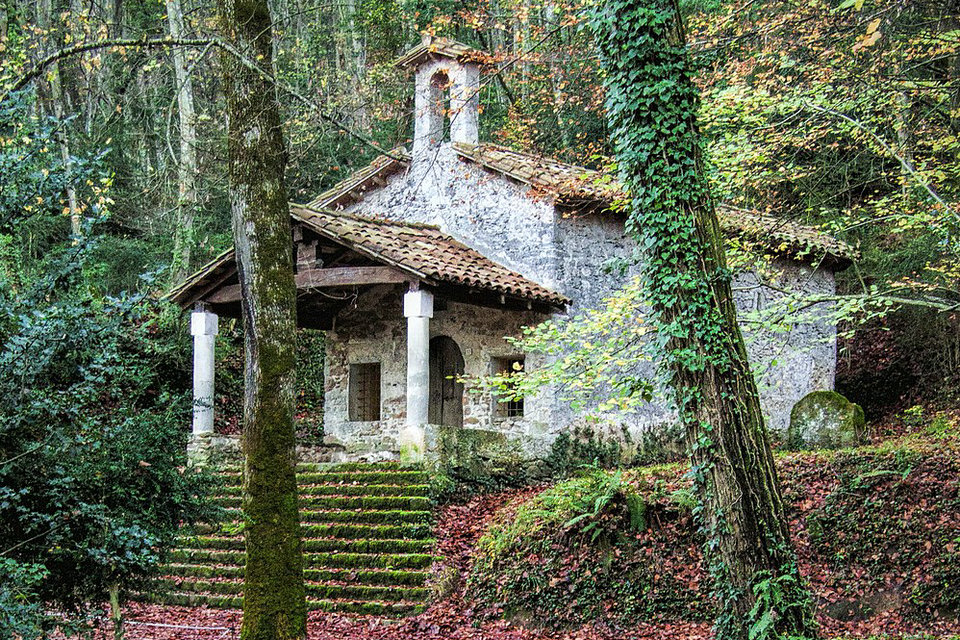
All this means that there are many places of interest in the natural park to visit: volcanic cones such as the Croscat volcanoes, Santa Margarida volcano, Montsacopa volcano, Sant Marc volcano, Traiter volcano, Racó volcano, etc.; lava flows such as those of Sant Joan les Fonts, those of Castellfollit de la Roca or those of Sant Feliu de Pallerols; forests such as the oak groves of La Moixina and the forest of Tosca, the Fageda d’en Jordà, the beech forests of La Salut; rural areas with farmhouses and neighborhoods such as Batet de la Serra, Sant Miquel Sacot, etc.; medieval old quarters such as Santa Pau and Sant Feliu de Pallerols; Romanesque monuments such as those of Sant Joan les Fonts, Santa Pau, the valley of the Crow, etc.; the modernist buildings of Olot, or museums such as the Garrotxa Museum and the Volcano Museum.
Among others, there are the following places of special natural interest
La Fageda d’en Jordà
The Croscat volcano
The volcano of Santa Margarida
The Batet plateau and Pujalós volcano
The forest of Tosca
The basaltic flow of Castellfollit de la Roca
The river Fluvià
The wetlands of La Deu and La Moixina
Different volcanoes in Olot:
Montsacopa
Bisaroques Volcano
Garrinada Volcano
Montolivet Volcano
Human presence
In the Garrocha Volcanic Zone there has always been a large and constant human population, which does not correspond to the typical image of a natural park. Man has transformed the landscape of the area at the same time that he has adapted to it. An example are the garrotxes, terrace- shaped crops (very useful in an area with steep reliefs) that gave the entire region its name. 98% of the park’s surface is private property. There are 11 municipalities in its interior, including Olot, the capital of the region.
Lapilli mining extractions for cement production, urban growth, and uncontrolled waste dumps have had an impact on the Park’s ecology. Its administration tries to make the preservation of the natural environment compatible with economic development.
Documentation Center
The Documentation Center of the Natural Park of the Volcanic Zone of La Garrotxa is a specialized library of the Park that provides access to knowledge and information about the space where it is located and other matters related to its management (protected areas, land management, hydrology, geology, soils, fauna, flora and vegetation, forests, agriculture and livestock, environmental education, landscape, cultural and intangible heritage, sustainable tourism, environmental impact…). It has a part of its virtual fund and another of physics located in Can Jordà Santa Pau, and offers personalized services for 3 types of users: technicians, researchers or professors, environmentally responsible institutions and companies and the general public.
Its main functions are the management and treatment of the documentary fund of the park and of the Network of Custody of the Territory, the attention of consultations, the diffusion and the participation in activities related to the management of the environmental information. Its strengths are personalized consultations, quality systems, virtuality and participation in networks, such as the Network of Documentation Centers of the Natural Parks of Catalonia, the Network of Specialized Libraries of the Generalitat de Catalunya or the Spanish Network RECIDA of environmental information and documentation centers.