Historical Theme Route in Turin City, Italy

Turin is an Italian municipality, fourth Italian municipality by population and capita city of the Piedmont region. A city with a two-thousand-year history, it was probably founded near its current position, around the third century BC, by the Taurini, then transformed into a Roman colony by Augustus with the name of Iulia Augusta Taurinorum in the first century BC. After the Ostrogothic dominion, it was the capital of an important Lombard duchy, and then passed, after becoming the capital of the Carolingian brand, under the nominal lordship of the Savoy in the 11th century. City of the homonymous duchy, in 1563 it became its capital. From1720 was the capital of the Kingdom of Sardinia (even if only de facto until the perfect merger of 1847, when it also became one formally), State that in the nineteenth century would have led to the Italian unification and that made Turin the first capital of Kingdom of Italy (from 1861 to 1865 ).
The history of Turin extends for more than two thousand years and some of its remains are still visible in the main monuments, streets and squares. In particular, the city became famous as the center of power of the House of Savoy, capital of the Savoy Duchy from the 15th century, then of the Kingdom of Sardinia, political fulcrum of the Risorgimento and the first capital of the Kingdom of Italy from 1861 to 1865. In the twentieth century, however, it became an important pole of the automotive industry worldwide.
Overview
Turin has a very ancient history. There are reports of settlements of Celto-Ligurian populations dating back to the third millennium BC, but in general the birth of the city is made to coincide with the foundation of a Roman castrum during the campaigns in Gaul led by Julius Caesar. The first Roman settlement in 28 BC became a real colony called Augusta Taurinorum (ie “Augusta dei Taurini”, one of the pre-existing Celtic-Ligurian peoples), from which the current toponym of Turin derives.
After the fall of the Roman Empire, Turin was subsequently governed by the Ostrogoths, the Lombards and the Franks of Charlemagne. In the year 940 the Marca di Torino was founded and the city passed under the dominion of the royal house of Savoy, becoming the capital of the duchy in 1576. In the following century the city expanded, exiting the Roman walls and conquering the area of Monferrato and the city of Asti, as well as an outlet to the sea.
From the beginning of the eighteenth century, after having repelled a long siege by the French and Spanish, the city finally became the capital of the Kingdom of Sardinia ruled by the Savoy.
At the beginning of the nineteenth century and after the Congress of Vienna, Turin was also assigned the kingdom of Genoa and Liguria, which laid the foundations for the unification of Italy that would take place in the following 50 years. Turin thus became the first capital of the Italian kingdom from 1861 to 1865, the year in which the rank of capital was assigned to Florence and, from 1870, to Rome. Since then Turin deprived of the luster of capital city, a policy of tax concessions was implemented which favored the establishment of new establishments and international trade fairs, which soon made it one of the major industrial cities in Italy.
The period of the Second World War was very hard for the city, which was repeatedly bombed. To this must be added the struggles between fascists and anti-fascists, in addition to numerous acts of violence perpetrated by the Nazis, it was freed by the partisan brigades.
The end of the war then saw Turin become, thanks to FIAT, the main industrial pole of the country, marking the path of the economic boom and attracting thousands of emigrants from southern Italy. Rai and Sip were also born in Turin, the first telecommunications companies in Italy.
In recent years, especially starting from the 2006 Winter Olympics, Turin has gone through an important phase of transformation with the modernization and redevelopment of numerous peripheral areas, which have brought it back to the splendor of its best times. Turin is also a city of culture, the International Book Fair is held here every year, one of the most important events in the sector, and is also one of the main headquarters of the Slow Food movement, which organizes Terra Madre and the Salone del Gusto. It houses the Egyptian Museum which is the second in the world for the importance of the collections collected.
The historical route
It is an exhibition conceived by a scientific committee and elaborated by MuseoTorino. The contents can be explored through multiple paths. The exhibition is divided into five priods, the visit of the permanent historical exhibition proposes a journey through time in which from before the city one passes to the ancient, medieval, modern city, up to the contemporary one.
Ancient Turin
2000-218 BC
From the first inhabitants of Piedmont to the Taurini
In the Bronze Age (2200-900 BC) the archaeological documentation highlights a progressive and continuous demographic increase in Piedmont, with the start of the formation of ethnic and linguistic groups which will then be mentioned by classical sources. In this period, thanks to an ever greater articulation of economic activities and the introduction of new specializations, a highly dynamic and mobile class of artisans and merchants emerged within the communities. Progressively, dominant elites were defined and the control of trade routes and increasingly large portions of territory was expanded and consolidated, albeit in a social structure still based on the village. The role of river navigation is affirmed, becoming a fundamental element for the organization of the geography of the populations of the plain, for the definition of the directions of trade and the determination of the importance and wealth of the settlements.
In the Iron Age (900-200 BC) the Turin area appears closely linked to the cultures of the Alpine and transalpine ‘Hallstatt’ world and inserted, like Piedmont, in the trade routes activated along the main river valleys by the merchants of the Etruscan and Italic centers, interested in the mineral deposits (copper, silver lead, iron) of the western Alps and exchanges with the Celtic populations of central Europe. In the context of these trades, the presence of imported artefacts, even of particular value, is frequently attested, probably destined for local leaders, in agreement with which the trade network was managed.
In the 4th century BC the impact of the Gallic invasions led to social and political upheaval and the collapse of the trading system linked to the Etruscan world; the river emporiums disappear, the specialized handicraft suffers a temporary recession and within the communities subgroups dedicated exclusively to war activity are formed. The presence of the ‘city of Taurini’ and the passage of Hannibal in 218 BC fit into this picture.
218 BC
Taurasia
Before the Romanization, the ancient sources hand down the existence of an inhabited center named Taurasia, probable capital of the Taurini, a name of the people that probably indicated not a single ethnic group but a set of tribes settled in the territories near the entrance of the roads led to the easier passes of the Cozie and Pennine Alps. It is perhaps precisely because of this location that the Taurini opposed Hannibal’s descent into Italy (218 BC), who, however, defeated them with relative ease and destroyed their settlement. This episode is the reason why the existence of a ‘city of Taurini’ finds its mention in Roman sources. Until now, archaeological research has not made it possible to locate this first settlement in any way: while the existence of pre-Roman settlements on the hills beyond the Po is documented, one can only suppose the presence of settlements in the plains near the river landings. Many scholars tend to solve the problem of the uncertain location of the Taurini capital by assuming that it arose near the confluence of the Dora and the Po, a particularly favorable site from a commercial and strategic point of view.
25/15 BC
Augusta Taurinorum
Rome’s attention to the north-western quadrant of northern Italy, north of the Po, is belated and only wakes up when the site becomes strategically important for the armies heading west, towards the Montgenevre pass, and north, towards the Piccolo and Gran San Bernardo hills. Despite the intensification of the Roman presence throughout the Po Valley in the 2nd century BC, the foundation of the colony of Augusta Taurinorum dates back only to the late 1st century BC, in the Augustan age – in any case after 27 BC.
With the drastic downsizing of Augustus’ project to bring the central European borders of the empire to the course of the Elbe river, following the Roman defeat in the Teutoburg forest (9 AD), also the importance of Augusta Taurinorum in the perspective of imperial politics decreases noticeably. As a result, the city actually leaves official history. However, archeology and inscriptions allow us to confirm the existence in the first centuries of the empire of an urban center with a good local vitality: in the 1st and 2nd century AD, craftsmen dedicated to the processing of glass and metals and the production of bricks and wine, as well as numerous soldiers, scattered throughout the empire, originally from Augusta Taurinorum. While, not a few inhabitants of the colony testify to a condition of progressive improvement of their social status and there is news of personalities who carry out a political career not only locally, but also at the imperial level. The city population does not exceed a few thousand units.
As regards the urban data, the survival of the two opposite corners of the perimeter walls – in correspondence with the current Egyptian museum and the Church of the Consolata – of the Roman city allows us to define the dimensions of Augusta Taurinorum: it was a rectangle of m 670×760. In today’s city it is possible to recognize the perimeter of the Roman walls in correspondence with via della Consolata for the west side and via Maria Vittoria / via Santa Teresa for the south side. The north side and the east side do not correspond to any modern street, but can easily be identified by imagining the continuation of the Porte Palatine and Palazzo Madama respectively.
398
Synod of Turin
In the final centuries of the empire, the city changed its appearance: from the 4th-5th century the ancient aristocratic domus fell into disrepair and were repaired or renovated with poor materials, such as wood and clay. Even public buildings underwent radical changes: the fate of the theater testified to, closed to shows and became a quarry for materials for the construction of the first cathedral that stands next to it. Christianity is precisely the ferment of a profound process of renewal not only civil and religious, but also urban planning, which starting from the creation of the episcopal see will polarize the development of the city in the centuries to come. Upon the arrival of the first bishop Massimo, consecrated between 371 and 397, the Turin Christian community must have been formed for some time and already venerated the local martyrs Solutore, Avventore and Ottavio,
Maximus, a bishop with a strong personality and vigorous pastoral action, endowed the diocese with the first structures and founded the cathedral, where in 398 an important synod of the bishops of Gaul met. This first church can be identified in the basilica of the Savior, discovered and reinterred in 1909, but brought to light by the archaeological excavations conducted between 1996 and 2008 in the area of the Duomo. Important traces have also emerged for the reconstruction of the complex events of the other two churches of San Giovanni and Santa Maria, which made up the group of the three twin basilicas demolished at the end of the fifteenth century for the construction of the current Cathedral. The remarkable monumental complex of the early Christian cathedral was completed between the end of the fifth century and the first decades of the sixth, in years of relative peace and good economic resources,
The medieval city
591
Capital of the Longobard Duchy
In 591 a duke of Turin, Agilulfo, is elected king of the Lombards, and is defined as ‘of Turin’ but also ‘duke of the Thuringians’: the Thuringians had probably allied themselves with the Lombards after their independent kingdom had been shot down by the Franks in 531. After entering Italy in 568, in 570 an occupation force had settled in the Turin area that included Lombards, Heruli and Thuringians. The overall Lombard leadership was out of the question, but the Thuringian families occupied a leading position in the Duchy of Turin which shared the government of the Piedmontese plain with the other Duchies of Asti, Ivrea and San Giulio d’Orta. These centers were fundamental in defining the control of the territories in which the Duchies were in fact not real provinces but generic areas of military settlement: that is, the dukes knew which tribal aggregates they governed, but not how far they could go.
At the base of the western Alpine arc passes the delicate border between the Frankish and Lombard dominations: the most important border points, along the great axes of communication, are located in the valleys of Aosta and Susa, in the fortified sites of Bard and Chiusa. After 575, when the Lombards ceded the valleys of Aosta and Susa to the Merovingian king Gontrano, Turin was more linked to the Po valley than to the transalpine regions, as was the case, before their arrival, with the domination of Sìsige, a Gothic chief recognized by Byzantium. For some years the same bishops of Turin had had to renounce the ecclesiastical government of some areas beyond the Mont Cenis pass. The strategic importance of the Duchy of Turin explains why, in addition to Agilulfo, two other Turin dukes, Arioaldo and Ragimperto, had obtained the crown of the Lombard kingdom and moved to the capital Pavia.
880
Capital of the Carolingian Marca
In 880 a count delegated by the Carolingians, Suppone, presided over a court session in Turin, providing proof of a new function of the city in the order of the empire built by the Franks. From 773 (after the Frankish king Charlemagne had defeated the Lombard king Desiderio) until 888 (when the emperor Carlo il Grosso was deposed) Turin became the capital of a Carolingian province (the Committee). From 888 to 950, when the Carolingian kings were no longer there, the Committee was part of a wider articulation, the Marca with its capital city Ivrea, extending the government of marquises over Turin (Anscario I and II, Adalberto, Berengario II) who reside more permanently outside the city, precisely in Ivrea. Turin nevertheless maintained its function as the center of the Comitatus Turin both in the period of the various kings who alternated on the throne of Italy,
From 950 to 1091 Turin was the capital, as well as of the Committee, of a vast Marca which also included Asti, Alba, some committees without urban centers (Auriate and Bredulo) and western Liguria (Albenga and Ventimiglia). This is the phase of the Middle Ages in which the ‘centrality’ of Turin is applied to the wider region, and in which the Turin marquises exercise undisputed control over the roads – in particular the Via Francigena della Valle di Susa directed towards the Mont Cenis pass.
The marquises of Turin administer their vast power from a palace located near the ‘Porta di Susa’ of the city. These influential governors (Arduino III, Manfredo, Olderico Manfredi) belong to a dynasty, the Arduinici – not relatives of the famous king Arduino d’Ivrea – who after the death of the Marquis Olderico Manfredi (1035) is held together by a woman, the countess Adelaide, who avoids its dispersion, governing ‘de facto’ for her three husbands (who have always died prematurely) a son and a husband of her daughter. The Marca collapsed in 1091 upon Adelaide’s death. From that year the power vacuum created in Turin allowed the bishops to develop not only ecclesiastical but also civil influence on the city, while the Turin area became a field of competition between different noble forces – before the arrival of the Savoy,
1091
Between Municipality and bishop
In 1091 the Countess of Turin Adelaide died and the capacity for cohesion and government of the Arduinic dynasty which had made the Turin city the political center of a large part of central-southern Piedmont and Liguria ceased. The Marca arduinica of Turin falls apart. Even civil power over Turin and the surrounding area remains with the bishop, who maintains it until the definitive affirmation of the Savoy in 1280. The Turin territory subject to the government of the bishops is not very extensive, and the border with respect to the Savoy advance is about two centuries in Rivoli, the bishop’s castle entrusted to a family of officials (advocates) from the Turin hills: the lords of Moncucco. Another very important bishop’s castle – used on some occasions as the bishop’s residence – is that of Testona,
Local noble powers are rooted around the city – the Baratonia, the Rivalta, the Piossasco and numerous others – who dominate in full autonomy, while the whole of southern Piedmont stopped orbiting Turin, becoming the scene of other affirmations, the marquises of Monferrato and Saluzzo. The noble powers of monasteries are also affirmed, such as San Giusto di Susa and San Michele della Chiusa in the Susa Valley. In Turin, the monastery of San Solutore has great development: from the center of Turin the abbey makes rich acquisitions of assets – in particular in Sangano and Carpice, in the territory of Moncalieri – where it is also ensured the exercise of stately powers.
In the first decades of the twelfth century, the bishop was joined by the Municipality, made up of families who had enriched themselves mainly with the loan of money and who grew stronger in good harmony with the bishop, to whom they gave vassal obedience. This relationship ensures that the first consuls and the families of the first municipal ruling class are in harmony with the bishop: the alliance between the bishop and the Municipality is made solid by the resistance to the advance of the Savoy, whose power until much of the thirteenth century reaches up to Avigliana.
The Turin municipality triggers competitions and temporary alliances with neighboring municipalities such as Chieri and Testona. Its dominant families have ambiguous social characteristics, partly bourgeois and partly aristocratic, they place their members in the college of canons of the cathedral and protect those religious bodies which, not limiting themselves to being communities of prayer, provide Turin society with hospital services and reception of the wayfarers. A rich man from Turin, Pietro Podisio, precisely pursuing these purposes of social utility, founded in 1146 the abbey-hospital of San Giacomo di Stura, today abbey of Stura.
1320
The city of Achaea
In 1280 the Marquis Guglielmo VII di Monferrato ceded Turin to Tomaso III of Savoy, but the succession passed to his brother Amedeo V who in 1294 left the dominions of Piedmont and the city to his nephew Filippo d’Acaia, son of Tomaso. With the passage under the Savoy family, the political autonomy of the Municipality of Turin wanes, even if the municipal executive body survives, controlled by the urban patriciate. An extreme attempt at an anti-Savoy revolt occurs again in 1334, suffocated by harsh repressions by the prince who, at the same time, favors the establishment of the Popular Society of San Giovanni to balance the magnate power, expanding to the new productive classes.
At the beginning of the fourteenth century Philip – whose title of Prince of Achaia derived from marriage to Isabella, daughter of Prince of Achaia William II of Villehardouin – also governed the southern area of the current province of Turin and that around Pinerolo, where Philip preferably resides: between 1317 and 1320 the prince, however, had the pre-existing castle of Porta Fibellona (now Palazzo Madama) restored. In the mid-fourteenth century Giacomo d’Acaia, with ambitions for independence, provokes the reaction of Amedeo VI (the Green Count) who declares him forfeited, claiming the principality for himself: Turin welcomes the Green Count, because in 1360 he returns the legislative freedom and approves the collection of new statutes (Book of the Chain). Even under the Savoy, from 1362 the resettled Acaia remained in power for another half century:
Under the Achaias the seat of the city government is located in the current Piazza Palazzo di Città, called platea Taurini or platea civitatis, then directly connected with the square of the church of San Gregorio (now San Rocco) in front of the Civic Tower, at the intersection between the current via Garibaldi and San Francesco. Nearby is the fish market, while the grain market takes place in front of the church of San Silvestro (now of Corpus Domini). Between the walls of the platea civitatis are the shoemakers ‘workshops and the butchers’ counters, surrounded by artisan shops. In this phase the demographic fluctuation is strong due to recurrent epidemics from 1348 to the first half of the fifteenth century: the population is probably around 3-4000 units.
The Municipality of Turin had not built a vast territorial district but – inheriting in part the 10 miles of district granted by Federico Barbarossa to the bishop in 1159 – controls a surrounding area of about 15 kilometers in radius. The suburban territory of the municipality is bordered to the north by the villages of Leinì, Caselle, Borgaro and Settimo, to the west by Collegno, Grugliasco and Rivalta, to the south by the Chisola stream and to the east by the hilly ridge between Moncalieri and Gassino. There are no villages with their own organized communities, except Grugliasco – however in the thirteenth century it was given to the lords of Piossasco – and Beinasco, two dependencies (‘titles’) that Turin maintained throughout the ancient regime.
On the right of the Po stands the church of San Vito «de Montepharato» with a small village: in the valley you can cross the river to reach the church of San Salvario. A real inhabited center, called Malavasio, must have risen in Val San Martino, and scattered settlements were located in Sassi. On the left bank the whole flat area is defined as the ‘countryside’ (Campanea) of Turin, as the name of Madonna di Campagna still attests, while to the west, on the various outlets of the Via Francigena, the village of San Donato has already developed and of Colleasca and the hospital foundations of Pozzo Strada.
The modern city
1404
Foundation of the university
A first sign of urban renewal is given in 1404 by the concession by the Avignonese Pope Benedict XIII to establish a Studium Generale in Turin, confirmed in 1412 by the emperor Sigismund. At the beginning, however, the University works in a discontinuous way, because the teachers prefer to reside and teach in Chieri and Savigliano, considered healthier during the recurring epidemics; only in 1436 did the obstinacy of the Turin city council obtain the ducal licenses which established the definitive seat of the Studium in the city. The building, which no longer exists, which housed it then stood in via San Francesco, in front of the church of San Rocco and next to the Civic Tower.
During the fifteenth century Turin began to become one of the most important bureaucratic centers of the Savoy territory, since the city had passed, with the extinction in 1418 of the Acaia branch – who had preferred Pinerolo – directly dependent on Duke Amedeo VIII of Savoy, to whom we owe the reorganization of the state. From this moment, thanks also to the prestige of its episcopal see, the city occasionally served as the seat of the prince and his court; in particular, the Consilium cum domino residens, an itinerant organism following the lord with political-administrative and judicial functions on all domains, meets with a certain frequency, even if there are occasions when its sessions are still held in the adjacent castles.
Subsequently, a new administrative body with specific competences for the area on this side of the Alps, called the Cismontano Council, decided to set up its headquarters in Turin in consideration of the city’s best road location towards the Lombard plain; finally, from 1459, it stabilized there permanently, meeting in the castle of Porta Fibellona, also due to the participation of bureaucratic staff who had left the Turin studio.
Another sign of the urban renewal is given by the purchase by the Municipality of Turin of the first nucleus of the current Palazzo Civico in 1472, while previously the council met in private houses or in the Tower. The attraction exercised by the city from the second half of the 15th century favors a reversal of the negative demographic flow: the new period of growth is certainly connected with the development of the new political centrality of the city; thanks to immigration, at the beginning of the following century the population reached 5-6000 units, doubling compared to a hundred years earlier, and expanded in the suburbs grown outside Porta Segusina and Porta Doranea and built near the bridge over the Po.
The century ends with the significant transformation of the old Cathedral complex: a first intervention took place in the 1960s with the erection of the new large bell tower (1469), but a radical architectural renewal took place with the bishop Domenico della Rovere, prelate of the curia Roman with the title of cardinal of San Clemente, who leaves his memory of patron in forms hitherto unknown in Piedmont, having the new Cathedral built according to the Renaissance dictates on a project by Bartolomeo di Francesco di Settignano, known as Meo del Caprina: the works they began in 1491 and lasted until 1505, when the church was solemnly consecrated.
1536
Gate of Italy
In the years of the ‘wars of Italy’ between the French and the Imperials, the passage of the armies of the kings of France followed one another, housed in the castle of Turin (Louis XII in 1507, Francesco I in 1515). To counter the French aims that had obtained the separation from the diocese of Turin from Saluzzo, erected as a bishopric in 1511, the duke Charles II and the bishop Giovanni Francesco della Rovere in 1513 succeeded in having the pope promote Turin to the seat of the archbishop. From a military point of view, the duke had four bastions built at the corners of the walls and a bulwark in front of the castle. Nonetheless, the French in 1536 occupied Turin with a certain ease, well received by the inhabitants, while the duke and the court retired to Vercelli. However, the French later provided for the strengthening of the square, by razing the villages outside the walls that prevent artillery firing. Thus the villages of Porta Segusina, Porta Dora and Po and the suburban churches, including the ancient abbey of San Solutore, disappear.
In 1538 the Savoyard Piedmont was annexed to the Kingdom of France and in 1539 Francesco I established a Parliament and the Court of Auditors in Turin, on the model of the French provincial capitals, but the university was temporarily suppressed.
In 1548, King Henry II triumphantly entered the city, now ruled by a viceroy. Only in December 1562 did the French leave the city: in February 1563 Duke Emanuele Filiberto entered, taking up residence in the archbishop’s palace. Under the French the city nevertheless experienced a further economic and demographic impulse – even if the 10-12000 units were exceeded only with the return of the Savoy and the subsequent organization of the court – maintaining its political and administrative primacy in Piedmont, favored by the position road that contributes to the development of its accommodation facilities: in this period there are over fifty hotels and taverns and some hoteliers reach a high rank, such as the owners of the Cappel Rosso hotel, located at the central intersection of via Garibaldi with via Porta Palatina and equipped with 14 beds and a cellar of five barrels. The arrangement of the Corona Grossa hotel (the building still exists in via IV Marzo), attested in 1523 as Hospicium Corone, can also be traced back to the first half of the sixteenth century.
1580
A fortress city
Military culture and urban design are the cornerstones of the prince’s initiative for the new state capital, transferred from Chambery to Turin in 1563. The project was concretely set up by the Dukes Emanuele Filiberto (1563-1580) and Carlo Emanuele I (1580) -1630) and finds its first phase of implementation in the expansion of the new city completed by Vittorio Amedeo I (1630-1637).
Fortifying and controlling the existing city are the objectives of Emanuele Filiberto’s urban policy, which is reflected in the strategic choice of placing the new Citadel and the settlement of the ducal residence at the two opposite vertices of the ancient Roman castrum: the imposing fortress designed by Francesco Paciotto and the ducal seat which is located in the green Bastion area, respond to defense needs while besieging the city of Turin. An analogous ambivalent position is taken by the Duke towards the Church: with the expropriation of the Bishop’s Palace to make it his residence, he goes against the strong powers rooted in the city, but at the same time favors religious orders by promoting alliance with the Jesuits with the construction of the church of the Holy Martyrs, designed by Pellegrino Tibaldi.
Carlo Emanuele I can thus devote himself to the project of the new civil city, which incorporates the old Roman and medieval city within an almond-shaped wall circuit, almost tripling its size. To the prefiguration of urban development as a mirror of the sovereign’s good governance, Carlo Emanuele I combines other image operations, such as the construction of the sanctuary for the exposition of the Shroud aimed at strengthening its role as defender of Catholic orthodoxy. The most significant intervention for the residences of the court is the decoration of the Grand Gallery (1608), which sees a significant shift in the project: from the genealogical celebration of the Savoy dynasty to a library, museum, chamber of wonders and antiques collection.
1680
An expanding city
With 1673, fidelity to the dynastic project and the image of the good government of the city are fully confirmed in the perfect adhesion between the program and the realization of the second extension of Turin, started on the axis of the military road of Po.
With the death of Charles Emmanuel II (1675) and the regency of Maria Giovanna Battista di Savoia Nemours (1675-1684) a period of dynastic weakness opens and the struggle for power risks cracking the continuity of the project for the regular city, endangered by grandiose-looking architecture, deliberately designed to dominate the uniform buildings and signal the seats of the aspiring government of the country: the project for the Collegio dei Nobili imagined by the Jesuit Carlo Maurizio Vota to celebrate Madama Reale (from 1678); the palace of the prince of Carignano, designed by Guarini (from 1679) looking at Bernini’s model for Louis XIV’s Louvre, as a prototype of a royal palace for a monarch of the absolute state.
The image of the dynasty finds a way to strengthen itself also through another side of public affirmation when it is associated with the representation of the divine, where the rule of uniformity gives way to the exception of the extraordinary and the bizarre. With the domes of the palatine chapels of the Shroud and of San Lorenzo, which like marvelous reliquaries emerge above the continuous curtain of the city, Guarino Guarini draws the ‘marvelous’ face of the presence of the Savoy in Turin.
The different choices made in the city in recent years find an aesthetic translation in the varied sensitivity to color, brought to signal continuity and fractures: white and gray for the ducal residences; exposed terracotta for the buildings of the state administration; black and gray for dynastic continuity in the Chapel of the Shroud; the colored marbles of Guarini for the interior of the San Lorenzo.
The contemporary city
1735
Capital of the Kingdom of Sardinia
Following the Treaty of Utrecht (1713) Turin also became the capital of the Kingdom of Sicily (changed over in 1718 with that of Sardinia) and the dukes of Savoy now hold the royal title, official recognition among the European powers. The period was marked by the government of Vittorio Amedeo II, who immediately started a process of institutional reforms within the state and at the same time decided to renew the architectural image of the capital, adapting it to the great international models. Having gone to Sicily in 1714, he met and called the Messina architect Filippo Juvarra, famous and active in Rome, to Turin and entrusted him with the task of designing the new urban scenography, configuring the modern image and adequate to the rank of eighteenth-century capital.
In a vision open to Europe, Juvarra, appointed as the first royal architect (1714), traces for the sovereign the theoretical profile of the urban renewal of the city-capital according to the principle of ‘widespread centrality’ based on the inseparable relationship that it establishes between the institutional government and the entire territory. Through the pure language of architecture, understood as a sign and expression of monumentality in the attention to the canons of treatises, Juvarra imposes his own unprecedented interpretation of the hierarchy of urban and outer space, overcoming – without ever formally denying – the characteristics of the seventeenth-century city.
Upon his arrival he immediately completed the urban planning project for the construction of the western extension of Turin in Porta Susina and began the design and completion of new emblematic buildings of the State (the ‘command area’ with the Secretariats of State and the Royal Archives; the barracks known as the Military Quarters) and the sovereign (the basilica of Superga, the building of Stupinigi, the unrealized project of the palace at the castle of Rivoli, the facade and the staircase of Palazzo Madama), as well as religious and civil buildings in the main places of city (the facade of the church of Santa Cristina, the church of Carmine, the church of San Filippo) It also starts the urban project of radical restructuring of the ancient city center, with the rectification and enlargement of the district of Porta Palazzo (the current Via Milano) and builds the two blocks at the head towards the north gate of the city, with the nearby rhomboid square. In 1735 the architect moved to Madrid, called by Philip V of Bourbon.
1780
A European capital
The programmatic continuity with the reformist work of Vittorio Amedeo II characterizes the long reign of Carlo Emanuele III (1730-1773) and therefore of Vittorio Amedeo III (1773-1796). During the eighteenth century plans and projects for the Savoyard capital matured at different scales: from the territory to the city, to the monumental complexes and the building fabric. If we exclude the two moments of building stasis following the wars of the Polish (1733-1735) and Austrian (1742-1748) succession, the period is marked by the consolidation of the lines already drawn, with an opening to reflections suggested by the spirit of rationality of the mold enlightened by Benedetto Alfieri, first royal architect from 1739 to 1767.
So it is the centralized judiciary and bureaucratic structures, supported by talented architects, to plan and manage the project of transformation of the city of absolutism until the years of French domination. The will of the sovereign responds to the adherence to a single project for the fortified city with an elliptical layout, organized inside according to a rigid centripetal road structure, supported by rector axes that connect the four urban gates to Piazza Castello and the Royal Palace.
Towards the middle of the eighteenth century with unity of purpose, Carlo Emanuele III and Benedetto Alfieri trace the new profile of the capital which replaces the Juvarrian scenographic idea with the rigor of the urban dimension, understood as the control activity exercised through the legislative instruments on the entire process of transformation of the city to promote public and private architecture with a uniform architectural image and attentive to functional aspects.
The objective is multiple: through new buildings to define the articulation of government activities – state and municipality – which require the multiplication of offices. At the same time we want to involve the new entrepreneurial nobility welcomed at the court, to actively work in construction through projects linked to urban income, in the framework of the ‘renovations’ started in the oldest and most degraded center of the city. The emerging classes look to a social model that envisages the possession of an urban building, a hilly ‘vineyard’ and a productive agricultural farmhouse in the plain. The program is broad and looks at the city and the territory, also in the widespread presence of construction sites opened in the suburban Savoy residences during the 18th century, whose importance as a Baroque territorial system is confirmed.
1808
Between Restoration and Development
With the definitive annexation of Piedmont to France in 1802, Turin, no longer the capital, became a service center and a commercial hub between Italy and France. The city takes on a different shape: while the dismantling of the ramparts begins, some large squares are built around the hinges of the ancient road outbuildings, connected to each other by a system of promenadesexternal trees. For the first time the Turinese are subjected to the payment of the land tax and, consequently, the works of the urban cadastre begin.
The city is divided into four districts – corresponding to the directions of trade flows – and the system introduced for the first time in Paris is applied, which, by assigning a fixed name to all the streets and squares of Turin, followed by the indication of a house number allows you to identify with certainty the domicile of each inhabitant. Vittorio Emanuele I, returning from exile in May 1814, crosses the solid Napoleonic bridge over the Po and finds himself in front of an unrecognizable city: in place of the ramparts, in the process of being dismantled, a large tree-lined esplanade, full of spaces to be built.
Turin, which returns to be the capital of a kingdom, inherits the French urban choices. The parade ground at the Citadel (in an area that was later completely built) and the leveling of the land at Porta Susa were built. The sale of the land of the demolished fortifications proceeds in the area of Piazza Emanuele Filiberto (now of the Republic) and of Porta Nuova (now Piazza Carlo Felice). The improvement of the economic situation and the demographic recovery determine an intense construction of these areas, together with that of the Borgo Nuovo between Porta Nuova and the Po. According to the directives of the court, in the mid-1920s the construction of Piazza di Po (now Vittorio Veneto), while the town hall intervenes in the construction of the square and the temple of the Great Mother of God on the opposite bank of the river.
1852
The moral capital of Italy
In 1848 the Town Hall regained its central role in the decisions relating to extensions and public works, also thanks to the acquisition of greater financial autonomy, according to which, in 1853, the route of the new customs belt was established, which an evident sign both in the structure of the city and in the building form. The previous year the enlargement plan had been approved, which conditioned the development of Turin in the second half of the 19th century. Also in 1852 the demolition of the Citadel was approved, making available an enormous extension of land, on which the new residential area of Piazza Statuto and Porta Susa stands and where the Novara railway station is located.
The connection to the Porta Nuova area, where the Genoa railway station was already located, is made through new routes (current Corso Vinzaglio and continuation of Viale del Re) traced on an orthogonal grid of tree-lined avenues which, unlike the large promenadesNapoleonic, are no longer ring roads of the built, but rector axes of the built structure and unpublished urban gardens.
The successful integration between the new area and the pre-existing city is also ensured by the use of the portico as a typifying element. Political emigration and robust financial investments are concentrated on Turin, the capital of the only Italian state that had maintained the freedoms introduced in 1848, resulting in an accelerated demographic growth, abruptly interrupted in 1864 due to the loss of the role of capital of the new Kingdom of Italy. It follows a massive exodus of the population and the restructuring of the economic system, hitherto strongly characterized by services to the court and by the presence of the government apparatus. Turin recovered slowly from the crisis during the seventies
1899
Turin that works and thinks
While on the squares and avenues of the center there are monuments in memory of the risorgimental characters that have now disappeared, with the 1980s a new phase begins, characterized by several simultaneous processes.
Outside the customs area, along the radial lines of connection with the territory, various settlements arise near the access gates to the city, according to the model of workers’ “barriers”. The towns Campidoglio, Regio Parco, Mont Blanc, Monte Rosa, via Giachino, Vittoria, of Nice, the result of subdivisions of small and medium-sized private properties, grow thanks to the absence of taxation on building materials and beyond the control of municipal legislation up to 1887. Within the customs belt, in the wide ring of land between the city proper and the broken line that defines the building obligation under the Ornate Regulations, two other areas of workers’ settlement were formed, that of Borgo San Paolo and that of Oltre Dora,
At the same time, the first urbanization of the foothills area on the right of the Po takes place, with the birth of bourgeois residential areas attested beyond the new bridges thrown over the Po, which partly overlooked the first large urban park, that of the Valentino. Also in the Eighties, debates inspired by hygienic rehabilitation purposes, but also by strong land interests, which led to the construction of the sewerage system and the diagonal “cuts” of via Pietro Micca and via IV Marzo, with the disappearance of almost all the medieval building cells, very degraded, and the reconversion of the previous role of poor residential area into a qualified residential area and home to banks, insurance companies, commercial firms. This phase can be considered concluded in 1908, with the first drafting of the new Regulatory Plan and the crisis of the automobile industry, which has just begun, which will determine in the following years a profound reorganization of the production sites.
1922
Between the two wars
The phase that opens after the First World War coincides first of all with a process of reorganization of the production structures that arose during the initial industrialization phase of the late nineteenth and early twentieth centuries. Symbols of this reorganization, from a “Fordist” and “Taylorist” perspective of concentration of the production sites, are the Fiat Lingotto and Mirafiori factories.
The plot that in some way supports and directs the expansion of the urbanized area towards the wide open spaces of the Turin plain is always that of the Regulatory Plan of 1906, together with the routes of the great historical axes and rivers.
However, the profound novelty lies in the fact that it is a transformation by large “pieces” – those of industry, of the planned social housing districts, of large collective services, of free time – which operate simultaneously by overlapping with the schedule pre-existing rural history and by juxtaposition with the buildings on the edge of the workers’ barriers
In addition to these elements, there are also the lines of the new road infrastructures, which impose an unprecedented reflection between mobility and the structure of the city.
It is a way of building the city – by concentration of functions and at the same time, however, by dispersion in space – which begins to dissolve the logic of Turin’s growth through contiguous extensions and traditional morphological rules – the texture of closed streets and blocks – and which anticipates that “New dimension” of the city that will take shape in a more radical way after World War II.
The reorganization work is also reflected within the historic city in the project for via Roma nuova, in which the rhetoric of the dictatorship and the rationalizing intentionality of the “Fordist” city seem to be able to coincide. In reality, the discontinuities of the morphology of the new built city are the product of a market that continues to be imperfect and around which new and ancient players collide.
1961
From city to metropolis
Turin, which from the Second World War pushed through the economic boom until the end of the 1970s, can be compared – using an effective image by Giorgio Rigotti for the 1956 Master Plan – to a sort of “big hand”, a spatial metaphor for growth like wildfire of the buildings that gradually invade the entire Turin plain. A strong and shared image, as shared is the idea that the city grows with and thanks to the factory, according to a process that assimilates it to a biological organism.
In this “gigantic infrastructure at the service of production”, as a Turin urban planner wrote, everything is brought back to the idea of the factory city: “Straight roads, so long that you can see the horizon, on fine days. They leave from the city center and go to Nice, Milan and France or Leningrad. The lives of Turin run parallel to the lines of Mirafiori and Lingotto and of Rivalta, and parallel to those lines ».
For many years, the circularity and overlap between work and living spaces – industries and workers’ districts – seemed to be total and absolute, without solutions of continuity. A city where even the historic center is transformed into a suburb: the upper class now lives in the hills. In this context, the celebrations for the centenary of the unification of Italy become an occasion for the construction of a moment “other” than the all-encompassing image of the city-factory. Monument and shared myth of modernization and of the new Turin of the great immigration from the south that leads it to exceed one million inhabitants, Italia ’61 tells of the hopes linked to the boom and the new center-left government. The only planned urban episode of a public matrix not attributable to the sole reasons for production and growth.
The systemic crisis of the second half of the 1970s implodes the industrial gigantism of previous decades. By emptying the consolidated industrial rear, the crisis renders for the first time the line of construction that advances in the countryside fragile.
2011
Between present and future
The systemic crisis of the late 1970s is taken as an opportunity to radically rethink the productive and morphological structure of Turin and its metropolitan area. Diversifying and articulating the economic and social matrix, rewriting and reconfiguring the physical structure are the watchwords that – as we become aware of the transformation underway – guide the change. At the heart of the change is the new city master plan, which, acting as a reference scenario, connects the multiple transformation projects. It is a mutation that places the emphasis on the frame of public transport (the Passante and the metropolitan railway service, the underground lines), on the rewriting of industrial fabrics (the reuse of the Lingotto, the Spine, the urban transformation zones),
Central in this phase is the guiding and supporting role played by the public sector, with the major events – from the Winter Olympic Games to the 150th anniversary of the Unification of Italy – which become an opportunity to support this plan for change. Central is also the historical parallelism operated between the end of the nineteenth century and the present: just as the city had had to reinvent itself as an industrial capital after the loss of its role as political capital, so today Turin must reinvent itself again to overcome the crisis of the manufacturing monoculture by challenging the its past, although the city always remains an important center of industry and innovative production. Physical metamorphosis, however, is not only of internal rewriting. While the Turin society changes, with a strong increase in the foreign component,
The future city
The transformations that began in the last decade of the twentieth century bring into play a fully metropolitan dimension of the Turin area, which needs to be both morphological and political at the same time. Within this unavoidable process of “metropolisation”, which should lead to a rewriting of the built environment avoiding new land consumption towards the outside, some large-scale projects can come to assume the role of frame within which to place the individual transformations.
First of all, the Metropolitan Railway Service, which, thanks to the Passante, by exploiting the radiocentric tracks on iron innervated to Turin, can represent an extraordinary opportunity not only to reconfigure the mobility of the Turin metropolitan area in a more sustainable way, but also for a profound rethinking of hierarchies and structures of the Turin area.
A second project-frame is that of Corona Verde, which, moving from the fires of the Savoy Residences of the Crown of Delights, aims to build an environmental ring capable of redeveloping and giving meaning to the fringes and peripheries of the metropolitan area. A project that joins that of Torino Città d’Acque, which uses the four rivers as environmental corridors capable of increasing the quality of the urban system. The individual projects are inserted on these frames and armouring: the fundamental one of Line 2 of the Metro, with the redevelopment of the neighborhoods of the northern area; the reuse of the immense disused industrial slabs located to the south and north of the city; the projects around Corso Marche; high railway capacity etc.
In practice, the vision of the three north-south linear centralities on which the 1995 master plan was built – the central Spina elongated at the Lingotto, Corso Marche, the Po Project – seems no longer enough. The vision is implemented by expanding to the entire metropolitan area, and the size of the projects seems to bring into play an overall geographical space in which rivers, plains, hills and the Alps fall.
Italy Liberation Theme
The Risorgimento is here.
It is an exhibition divided into 5 itineraries, to discover Turin in the decisive 50 years for the history of our country: from 1814, with the return of Vittorio Emanuele I on the throne of the Savoy kingdom, until 1861 with the proclamation of the Kingdom of Italy, and the transfer of the capital from Turin to Florence in 1864. Places, events and characters are illustrated with both period and current images, to reconstruct the historical fabric and the salient episodes that have affected the centers of political and religious power in the city.
The historic buildings tell their own history and the events of which they were the theater; the monuments and commemorative plaques make known the protagonists of the restoration, of the secret societies, of the riots of 1821, of the revolutions of ’48 and of the technological innovations that led to the creation of a modern unitary state.
The command posts
In the central area of the city – piazza Castello and piazza Carignano – the historic heart of Turin, the government buildings are enclosed (Palazzo Reale, Palazzo Madama with the Senate Hall and Palazzo Carignano with the Parliament, the royal secretariats seat of ministries and government offices), the monuments depicting the Standard Bearer of the Sardinian Army and the Knight of Italy, the tombstones that recall crucial moments in the history of our country, such as the First War of Independence or emblematic characters such as Federico Sclopis, Luigi Des Ambrois and Antonio Benedetto Carpano. It is a short but very intense itinerary of suggestions, which immerses the visitor in the environments of the Savoy court and in the memories it contains.
Riots and conspiracies
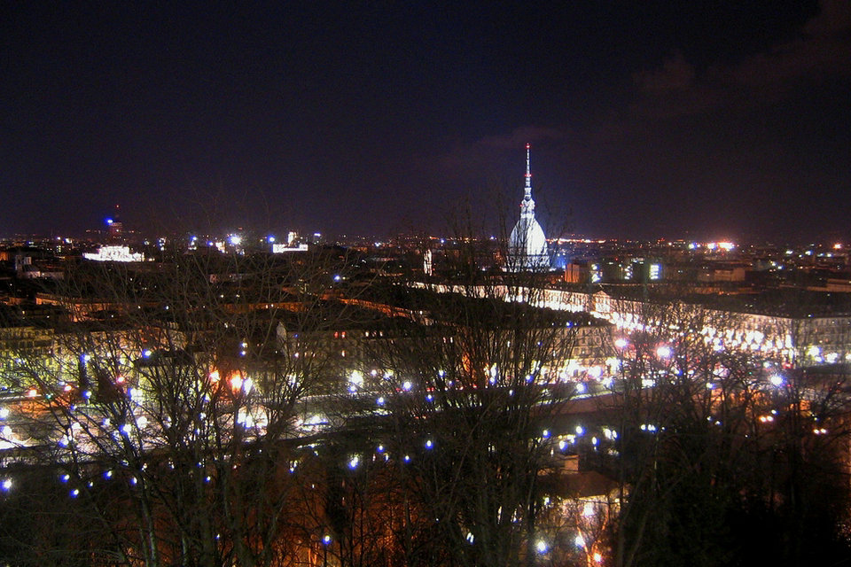
The arcades of the ancient Via Po still preserve the places of the conspiracies and revolutionary uprisings of the Risorgimento: the riots of 1821 in the courtyard of the University rectorate, the conspiracies in the muffled rooms of the Fiorio coffee, also called “dei codini”, as many conservative nobles who wore the typical wig with the “tail”. The itinerary also reaches the plaque commemorating where Goffredo Mameli first played the hymn of the Italians or the symbol of Turin: the Mole Antonelliana, designed as a synagogue and used instead as the first seat of the Risorgimento Museum, reaching – after crossing piazza Vittorio and the stone bridge – to the Gran Madre di Dio and to Villa della Regina, then the seat of the National Institute of the daughters of the Italian military.
Modernization
The spirit of the modernization of the unitary state can be identified in the itinerary that connects the monuments of the characters of the Italian Risorgimento, such as Giuseppe Garibaldi and Massimo d’Azeglio, to the obelisk in memory of the 1855 expedition to the Crimea – a strategic episode in Cavour’s foreign policy – to the symbolic places of the Carmelite religious emancipation of 1848, such as the Waldensian Temple, to the Porta Nuova station – the ancient landing stage of Genoa – which made Piedmont the pre-unification kingdom with the greatest railway extension. The memory given by the Park of Italy ’61 in the centenary of the unification of Italy and the column that commemorates the anniversary, symbolize a fundamental passage in the history of the first capital of the Kingdom of Italy.
The Fathers of the Fatherland
A path in the central area of the city – built on the remains of the ancient walls and bastions destroyed by Napoleon at the beginning of the 19th century and today pleasant gardens and tree-lined squares – which touches the palaces and monuments of the great statesmen, Fathers of the Fatherland, such as Gioberti, Cavour, Mazzini and Manin, together with tombstones commemorating heroes and intellectuals such as Pietro Fortunato Calvi and Lajos Kossuth, Giuditta Sidoli and Roberto d’Azeglio, and events such as the riots in Piazza San Carlo for the transfer of the capital from Turin to Florence in 1864. The nineteenth-century city can be read in a succession of countless stages, which alternate austere noble palaces – the Collegio dei Nobili, Palazzo Cavour, Palazzo d’Azeglio, and the Academy of Fine Arts – with monuments and tombstones in memory of those who dedicated the life to the realization of the unification of Italy.
Vittorio Emanuele II
From the historic heart of Turin, the seat of the command of the Savoy kingdom, then of Italy, you can “visit” the plaque commemorating where Michele Novaro set to music the song composed by Goffredo Mameli and which became the national anthem in 1946, the Palazzo di Città headquarters of the town hall, the square that recalls the name of the Statute of 1848 granted by Carlo Alberto together with the monument that celebrates the Frejus railway tunnel inaugurated in 1871 and the contiguous Porta Susa station, terminus of the railway from Novara. The ancient Keep of the Citadel, which recalls the Carbonari Moti of 1821, overlooks the avenue leading to the highest monument in the city, the one dedicated to the first King of Italy. Placed on four imposing Doric columns, Vittorio Emanuele II seems to walk on the roofs of the surrounding buildings, floating on the tree-lined boulevard that takes his name.