Urban sprawl or suburban sprawl describes the expansion of human populations away from central urban areas into low-density, monofunctional and usually car-dependent communities, in a process called suburbanization. In addition to describing a particular form of urbanization, the term also relates to the social and environmental consequences associated with this development. In Continental Europe the term “peri-urbanisation” is often used to denote similar dynamics and phenomena, although the term urban sprawl is currently being used by the European Environment Agency. There is widespread disagreement about what constitutes sprawl and how to quantify it. For example, some commentators measure sprawl only with the average number of residential units per acre in a given area. But others associate it with decentralization (spread of population without a well-defined centre), discontinuity (leapfrog development, as defined below), segregation of uses, and so forth.
The term urban sprawl is highly politicized, and almost always has negative connotations. It is criticized for causing environmental degradation, and intensifying segregation and undermining the vitality of existing urban areas and attacked on aesthetic grounds. Due to the pejorative meaning of the term, few openly support urban sprawl as such. The term has become a rallying cry for managing urban growth.
Definition
Definitions of sprawl vary; researchers in the field acknowledge that the term lacks precision. Batty et al. defined sprawl as “uncoordinated growth: the expansion of community without concern for its consequences, in short, unplanned, incremental urban growth which is often regarded unsustainable.” Bhatta et al. wrote in 2010 that despite a dispute over the precise definition of sprawl there is a “general consensus that urban sprawl is characterized by unplanned and uneven pattern of growth, driven by multitude of processes and leading to inefficient resource utilization.”
Reid Ewing has shown that sprawl has typically been characterized as urban developments exhibiting at least one of the following characteristics: low-density or single-use development, strip development, scattered development, and/or leapfrog development (areas of development interspersed with vacant land). He argued that a better way to identify sprawl was to use indicators rather than characteristics because this was a more flexible and less arbitrary method. He proposed using “accessibility” and “functional open space” as indicators. Ewing’s approach has been criticized for assuming that sprawl is defined by negative characteristics.
What constitutes sprawl may be considered a matter of degree and will always be somewhat subjective under many definitions of the term. Ewing has also argued that suburban development does not, per se constitute sprawl depending on the form it takes, although Gordon & Richardson have argued that the term is sometimes used synonymously with suburbanization in a pejorative way.
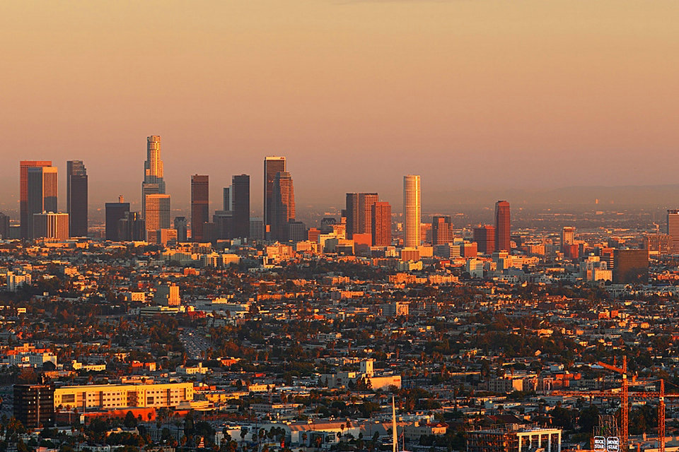
Metropolitan Los Angeles for example, despite popular notions of being an sprawling city, is the densest metropolitan region in the US; Being denser than the New York metropolitan area and the San Francisco Bay Area. Essentially, most of metropolitan Los Angeles is built at more uniform low to moderate density, leading to a much higher overall density for the entire region. This is in contrast to cities such as New York, San Francisco or Chicago which have extremely compact, high density, cores but are surrounded by large areas of extremely low density.
The international cases of sprawl often draw into question the definition of the term and what conditions are necessary for urban growth to be considered sprawl. Metropolitan regions such Greater Mexico City, Delhi National Capital Region and Beijing, are often regarded as sprawling despite being relatively dense and mixed use.
Characteristics
Despite the lack of a clear agreed upon description of what defines sprawl most definitions often associate the following characteristics with sprawl.
Single-use development
This refers to a situation where commercial, residential, institutional and industrial areas are separated from one another. Consequently, large tracts of land are devoted to a single use and are segregated from one another by open space, infrastructure, or other barriers. As a result, the places where people live, work, shop, and recreate are far from one another, usually to the extent that walking, transit use and bicycling are impractical, so all these activities generally require an automobile. The degree to which different land uses are mixed together is often used as an indicator of sprawl in studies of the subject.
Job sprawl and spatial mismatch
Job sprawl is another land use symptom of urban sprawl and car-dependent communities. It is defined as low-density, geographically spread-out patterns of employment, where the majority of jobs in a given metropolitan area are located outside of the main city’s central business district (CBD), and increasingly in the suburban periphery. It is often the result of urban disinvestment, the geographic freedom of employment location allowed by predominantly car-dependent commuting patterns of many American suburbs, and many companies’ desire to locate in low-density areas that are often more affordable and offer potential for expansion. Spatial mismatch is related to job sprawl and economic environmental justice. Spatial mismatch is defined as the situation where poor urban, predominantly minority citizens are left without easy access to entry-level jobs, as a result of increasing job sprawl and limited transportation options to facilitate a reverse commute to the suburbs.
Job sprawl has been documented and measured in various ways. It has been shown to be a growing trend in America’s metropolitan areas. The Brookings Institution has published multiple articles on the topic. In 2005, author Michael Stoll defined job sprawl simply as jobs located more than 5-mile (8.0 km) radius from the CBD, and measured the concept based on year 2000 U.S. Census data. Other ways of measuring the concept with more detailed rings around the CBD include a 2001 article by Edward Glaeser and Elizabeth Kneebone’s 2009 article, which show that sprawling urban peripheries are gaining employment while areas closer to the CBD are losing jobs. These two authors used three geographic rings limited to a 35-mile (56 km) radius around the CBD: 3 miles (4.8 km) or less, 3 to 10 miles (16 km), and 10 to 35 miles (56 km). Kneebone’s study showed the following nationwide breakdown for the largest metropolitan areas in 2006: 21.3% of jobs located in the inner ring, 33.6% of jobs in the 3-10 mile ring, and 45.1% in the 10-35 mile ring. This compares to the year 1998 – 23.3%, 34.2%, and 42.5% in those respective rings. The study shows CBD employment share shrinking, and job growth focused in the suburban and exurban outer metropolitan rings.
Low-density
Sprawl is often characterized as consisting of low-density development. The exact definition of “low density” is arguable, but a common example is that of single family homes on large lots. Buildings usually have fewer stories and are spaced farther apart, separated by lawns, landscaping, roads or parking lots. Specific measurements of what constitutes low-density is culturally relative; for example, in the United States 2-4 houses per acre might be considered low-density while in the UK 8-12 would still be considered low-density. Because more automobiles are used much more land is designated for parking. The impact of low density development in many communities is that developed or “urbanized” land is increasing at a faster rate than the population is growing.
Overall density is often lowered by “leapfrog development”. This term refers to the relationship, or lack thereof, between subdivisions. Such developments are typically separated by large green belts, i.e. tracts of undeveloped land, resulting in an average density far lower even than the low density indicated by localized per-acre measurements. This is a 20th and 21st century phenomenon generated by the current custom of requiring a developer to provide subdivision infrastructure as a condition of development. Usually, the developer is required to set aside a certain percentage of the developed land for public use, including roads, parks and schools. In the past, when a local government built all the streets in a given location, the town could expand without interruption and with a coherent circulation system, because it had condemnation power. Private developers generally do not have such power (although they can sometimes find local governments willing to help), and often choose to develop on the tracts that happen to be for sale at the time they want to build, rather than pay extra or wait for a more appropriate location.
Conversion of agricultural land to urban use
Land for sprawl is often taken from fertile agricultural lands, which are often located immediately surrounding cities; the extent of modern sprawl has consumed a large amount of the most productive agricultural land, as well as forest, desert and other wilderness areas. In the United States the seller may avoid tax on profit by using a tax break exempting like-kind exchanges from capital gains tax; proceeds from the sale are used to purchase agricultural land elsewhere and the transaction is treated as a “swap” or trade of like assets and no tax is due. Thus urban sprawl is subsidized by the tax code. In China, land has been converted from rural to urban use in advance of demand, leading to vacant rural land intended for future development, and eventual urban sprawl.
Housing subdivisions
Housing subdivisions are large tracts of land consisting entirely of newly built residences. New Urbanist architectural firm Duany Plater-Zyberk & Company claim that housing subdivisions “are sometimes called villages, towns, and neighbourhoods by their developers, which is misleading since those terms denote places that are not exclusively residential.” They are also referred to as developments.
Subdivisions often incorporate curved roads and cul-de-sacs. These subdivisions may offer only a few places to enter and exit the development, causing traffic to use high volume collector streets. All trips, no matter how short, must enter the collector road in a suburban system.
Lawn
Because the advent of sprawl meant more land for lower costs, home owners had more land at their disposal, and the development of the residential lawn after the Second World War became commonplace in suburbs, notably, but not exclusively in North America. The creation in the early 20th century of country clubs and golf courses completed the rise of lawn culture in the United States. Lawns now take up a significant amount of land in suburban developments, contributing in no small part to sprawl.
Commercial characteristics
In areas of sprawl, commercial use is generally segregated from other uses. In the U.S. and Canada, these often take the form of strip malls, which refer to collections of buildings sharing a common parking lot, usually built on a high-capacity roadway with commercial functions (i.e., a “strip”). Similar developments in the UK are called Retail Parks. Strip malls consisting mostly of big box stores or category killers are sometimes called “power centers” (U.S.). These developments tend to be low-density; the buildings are single-story and there is ample space for parking and access for delivery vehicles. This character is reflected in the spacious landscaping of the parking lots and walkways and clear signage of the retail establishments. Some strip malls are undergoing a transformation into Lifestyle centers; entailing investments in common areas and facilities (plazas, cafes) and shifting tenancy from daily goods to recreational shopping.
Another prominent form of retail development in areas characterized by sprawl is the shopping mall. Unlike the strip mall, this is usually composed of a single building surrounded by a parking lot that contains multiple shops, usually “anchored” by one or more department stores (Gruen and Smith 1960). The function and size is also distinct from the strip mall. The focus is almost exclusively on recreational shopping rather than daily goods. Shopping malls also tend to serve a wider (regional) public and require higher-order infrastructure such as highway access and can have floorspaces in excess of a million square feet (ca. 100,000 m²). Shopping malls are often detrimental to downtown shopping centres of nearby cities since the shopping malls act as a surrogate for the city centre (Crawford 1992). Some downtowns have responded to this challenge by building shopping centres of their own (Frieden and Sagelyn 1989).
Fast food chains are often built early in areas with low property values where the population is expected to boom and where large traffic is predicted, and set a precedent for future development. Eric Schlosser, in his book Fast Food Nation, argues that fast food chains accelerate suburban sprawl and help set its tone with their expansive parking lots, flashy signs, and plastic architecture (65). Duany Plater Zyberk & Company believe that this reinforces a destructive pattern of growth in an endless quest to move away from the sprawl that only results in creating more of it.
Causes
Urbanization
The density gradient of industrialising cities has tended to follow a specific pattern: the density of the centre of the city would rise during urbanization and the population would remain heavily concentrated in the city centre with a rapid decline in settlement towards the periphery. Then, with continued economic growth and the expanding networks of public transport, people (particularly the middle class) would then slowly migrate towards the suburbs, gradually softening the population density gradient. This point was generally reached when the city reached a certain stage of economic development. In London, this point was reached in the first half of the 19th century, in Paris toward the end of the century and in New York City at the turn of the 20th.
The term “urban sprawl” was first used in an article in The Times in 1955 as a negative comment on the state of London’s outskirts. However, London had been sprawling out of its medieval confines within the City since the 18th century, when the city experienced its first great urban surge. Areas to the west of Westminster were increasingly built up for the wealthy, to live in the suburbs of the city.
A dramatic increase in the city’s urban sprawl began in the 19th century, when labourers flocked from the countryside to work in the new factories that were then springing up. Large developments of small terraced houses began to appear and the new public transportation systems – (the metro, buses and trams) – allowed workers to commute into the city daily. Suburban districts also sprung up around the city centre to accommodate those who wanted to escape the squalid conditions of the industrial town.
By the mid-19th century, the first major suburban areas were springing up around London as the city (then the largest in the world) became more overcrowded and unsanitary. A major catalyst in the growth in urban sprawl came from the opening of the Metropolitan Railway in the 1860s. The line joined the capital’s financial heart in the City to what were to become the suburbs of Middlesex. Harrow was reached in 1880, and the line eventually extended as far as Verney Junction in Buckinghamshire, more than 50 miles (80 kilometres) from Baker Street and the centre of London.
Unlike other railway companies, which were required to dispose of surplus land, the Met was allowed to retain such land that it believed was necessary for future railway use. Initially, the surplus land was managed by the Land Committee, and, from the 1880s, the land was developed and sold to domestic buyers in places like Willesden Park Estate, Cecil Park, near Pinner and at Wembley Park. In 1919, with the expectation of a postwar housing boom, Metropolitan Railway Country Estates Limited was formed and went on to develop estates at Kingsbury Garden Village near Neasden, Wembley Park, Cecil Park and Grange Estate at Pinner and the Cedars Estate at Rickmansworth and create places such as Harrow Garden Village.
By the early twentieth century then, amid increasing middle-class affluence, large low-density suburbs of semi-detached houses had sprung up all around the city, doubling the area of built-up London in the interwar period alone, despite the population increase being just 10 percent. H.G Wells even predicted in 1902 that within a hundred years most of southern England would have been subsumed into one gigantic conurbation centred in London.
Early attempts at combatting urban sprawl
Starting in the early 20th century, environmentalist opposition to urban sprawl began to coalesce, with roots in the garden city movement, as well as pressure from campaign groups such as the Campaign to Protect Rural England (CPRE).
Under Herbert Morrison’s 1934 leadership of the London County Council, the first formal proposal was made by the Greater London Regional Planning Committee “to provide a reserve supply of public open spaces and of recreational areas and to establish a green belt or girdle of open space”. It was again included in an advisory Greater London Plan prepared by Patrick Abercrombie in 1944. The Town and Country Planning Act of 1947 expressly incorporated green belts into all further national urban developments.
New provisions for compensation in the 1947 Town and Country Planning Act allowed local authorities around the country to incorporate green belt proposals in their first development plans. The codification of Green Belt policy and its extension to areas other than London came with the historic Circular 42/55 inviting local planning authorities to consider the establishment of Green Belts. The first urban growth boundary in the U.S. was in Fayette County, Kentucky in 1958.
Examples
According to the National Resources Inventory (NRI), about 8,900 square kilometres (2.2 million acres) of land in the United States was developed between 1992 and 2002. Presently, the NRI classifies approximately 100,000 more square kilometres (40,000 square miles) (an area approximately the size of Kentucky) as developed than the Census Bureau classifies as urban. The difference in the NRI classification is that it includes rural development, which by definition cannot be considered to be “urban” sprawl. Currently, according to the 2000 Census, approximately 2.6 percent of the U.S. land area is urban. Approximately 0.8 percent of the nation’s land is in the 37 urbanized areas with more than 1,000,000 population. In 2002, these 37 urbanized areas supported around 40% of the total American population.
Nonetheless, some urban areas like Detroit have expanded geographically even while losing population. But it was not just urbanized areas in the U.S. that lost population and sprawled substantially. According to data in “Cities and Automobile Dependence” by Kenworthy and Laube (1999), urbanized area population losses occurred while there was an expansion of sprawl between 1970 and 1990 in Amsterdam, the Netherlands; Brussels, Belgium; Copenhagen, Denmark; Frankfurt, Hamburg and Munich, Germany; and Zurich, Switzerland, albeit without the dismantling of infrastructure that occurred in the United States.
Effects
Environmental
Urban sprawl is associated with a number of negative environmental outcomes.
One of the major environmental problems associated with sprawl is land loss, habitat loss and subsequent reduction in biodiversity. A review by Czech and colleagues finds that urbanization endangers more species and is more geographically ubiquitous in the mainland United States than any other human activity. Urban sprawl is disruptive to native flora & fauna and introduces invasive plants into their environments. Although the effects can be mitigated through careful maintenance of native vegetation, the process of ecological succession and public education, sprawl represents one of the primary threats to biodiversity.
Regions with high birth rates and immigration are therefore faced with environmental problems due to unplanned urban growth and emerging megacities such as Kolkata.
Other problems include:
flooding, which results from increased impervious surfaces for roads and parking (see urban runoff)
increased temperatures from heat islands, which leads to a significantly increased risk of mortality in elderly populations.
At the same time, the urban cores of these and nearly all other major cities in the United States, Western Europe, and Japan that did not annex new territory experienced the related phenomena of falling household size and, particularly in the U.S., “white flight”, sustaining population losses. This trend has slowed somewhat in recent years, as more people have regained an interest in urban living.
Due to the larger area consumed by sprawling suburbs compared to urban neighborhoods, more farmland and wildlife habitats are displaced per resident. As forest cover is cleared and covered with impervious surfaces (concrete and asphalt) in the suburbs, rainfall is less effectively absorbed into the groundwater aquifers. This threatens both the quality and quantity of water supplies. Sprawl increases water pollution as rain water picks up gasoline, motor oil, heavy metals, and other pollutants in runoff from parking lots and roads.
Gordon & Richardson have argued that the conversion of agricultural land to urban use is not a problem due to the increasing efficiency of agricultural production; they argue that aggregate agricultural production is still more than sufficient to meet global food needs despite the expansion of urban land use.
Health
Sprawl leads to increased driving, and increased driving leads to vehicle emissions that contribute to air pollution and its attendant negative impacts on human health. In addition, the reduced physical activity implied by increased automobile use has negative health consequences. Sprawl significantly predicts chronic medical conditions and health-related quality of life, but not mental health disorders. The American Journal of Public Health and the American Journal of Health Promotion, have both stated that there is a significant connection between sprawl, obesity, and hypertension.
In the years following World War II, when vehicle ownership was becoming widespread, public health officials recommended the health benefits of suburbs due to soot and industrial fumes in the city center. However, air in modern suburbs is not necessarily cleaner than air in urban neighborhoods. In fact, the most polluted air is on crowded highways, where people in suburbs tend to spend more time. On average, suburban residents generate more per capita pollution and carbon emissions than their urban counterparts because of their increased driving.
Safety
A heavy reliance on automobiles increases traffic throughout the city as well as automobile crashes, pedestrian injuries, and air pollution. Motor vehicle crashes are the leading cause of death for Americans between the ages of five and twenty-four and is the leading accident-related cause for all age groups. Residents of more sprawling areas are generally at greater risk of dying in a car crash due to increased exposure to driving. Evidence indicates that pedestrians in sprawling areas are at higher risk than those in denser areas, although the relationship is less clear than for drivers and passengers in vehicles.
Research covered in the Journal of Economic Issues and State and Local Government Review shows a link between sprawl and emergency medical services response and fire department response delays.
Increased infrastructure/transportation costs
Living in larger, more spread out spaces generally makes public services more expensive. Since car usage becomes endemic and public transport often becomes significantly more expensive, city planners are forced to build highway and parking infrastructure, which in turn decreases taxable land and revenue, and decreases the desirability of the area adjacent to such structures. Providing services such as water, sewers, and electricity is also more expensive per household in less dense areas.
Residents of low-density areas spend a higher proportion of their income on transportation than residents of high density areas. The RAC estimates that the average cost of operating a car in the UK is £5,000 a year, most of which stems from financing costs and depreciation.
Social
Urban sprawl may be partly responsible for the decline in social capital in the United States. Compact neighborhoods can foster casual social interactions among neighbors, while sprawl creates barriers. Sprawl tends to replace public spaces with private spaces such as fenced-in backyards.
Critics of sprawl maintain that sprawl erodes quality of life. Duany and Plater-Zyberk believe that in traditional neighborhoods the nearness of the workplace to retail and restaurant space that provides cafes and convenience stores with daytime customers is an essential component to the successful balance of urban life. Furthermore, they state that the closeness of the workplace to homes also gives people the option of walking or riding a bicycle to work or school and that without this kind of interaction between the different components of life the urban pattern quickly falls apart. James Howard Kunstler has argued that poor aesthetics in suburban environments make them “places not worth caring about”, and that they lack a sense of history and identity.
Urban sprawl has class and racial implications in many parts of the world; the relative homogeneity of many sprawl developments may reinforce class and racial divides through residential segregation.
Numerous studies link increased population density with increased aggression. Some people believe that increased population density encourages crime and anti-social behavior. It is argued that human beings, while social animals, need significant amounts of social space or they become agitated and aggressive. However, the relationship between higher densities and increased social pathology has been largely discredited.
Alternative development styles
The term ‘smart growth’ has been particularly used in North America. The terms ‘compact city’ or ‘urban intensification’ are often used to describe similar concepts in Europe and particularly the UK where it has influenced government policy and planning practice in recent years.
The state of Oregon enacted a law in 1973 limiting the area urban areas could occupy, through urban growth boundaries. As a result, Portland, the state’s largest urban area, has become a leader in smart growth policies that seek to make urban areas more compact (they are called urban consolidation policies). After the creation of this boundary, the population density of the urbanized area increased somewhat (from 1,135 in 1970 to 1,290 per km² in 2000). While the growth boundary has not been tight enough to vastly increase density, the consensus is that the growth boundaries have protected great amounts of wild areas and farmland around the metro area.
Many parts of the San Francisco Bay Area have also adopted urban growth boundaries; 25 of its cities and 5 of its counties have urban growth boundaries. Many of these were adopted with the support and advocacy of Greenbelt Alliance, a non-profit land conservation and urban planning organization.
In other areas, the design principles of District Regionalism and New Urbanism have been employed to combat urban sprawl. The concept of Circular flow land use management has been developed in Europe to reduce land take by urban sprawl through promoting inner-city and brownfield development.
While cities such as Los Angeles are well known for sprawling suburbs, policies and public opinion are changing. Transit-oriented development, in which higher-density mixed-use areas are permitted or encouraged near transit stops is encouraging more compact development in certain areas-particularly those with light and heavy rail transit systems.
Bicycles are the preferred means of travel in many countries. Also, bicycles are permitted in public transit. Businesses in areas of some towns where bicycle use is high are thriving. Bicycles and transit are contributing in two important ways toward the success of businesses:
First, is that on average the people living the closest to these business districts have more money to spend locally because they don’t spend as much on their cars.
Second, because these people rely more on bicycling, walking and transit than on driving, they tend to focus more of their commerce on locally owned neighborhood businesses that are convenient for them to reach.
Walkability is a measure of how friendly an area is to walking. Walkability has many health, environmental, and economic benefits. However, evaluating walkability is challenging because it requires the consideration of many subjective factors. Factors influencing walkability include the presence or absence and quality of footpaths, sidewalks or other pedestrian right-of-ways, traffic and road conditions, land use patterns, building accessibility, and safety, among others. Walkability is an important concept in sustainable urban design.
Source from Wikipedia