Roquefort-les-Pins is a French commune located in the department of Alpes-Maritimes in the region Provence-Alpes-Côte d’Azur, standing at 18 km from Cannes, 17 km from the Nice airport and 13 km from Grasse.
The village is situated between 200 and 300 metres above sea level. Roquefort-Les-Pins is surrounded by a pine forest and rocky landscape, making it a picturesque Cote D’azur village. The river Miagne is situated to the north of the commune, running parallel to the D7 national road. The commune is cut into 4 zones expanding from the center: A heavily forested zone, a sparsely populated zone, a moderately populated zone and a densely populated zone.
The “first men” already inhabited this hospitable land, spared from climatic excesses, offering plains suitable for cultivation, elevations, a network of never dried up streams and numerous caves to the delight of speleologists.
Today, Roquefort-les-Pins still offers a green and peaceful environment to its inhabitants, a residential village par excellence at the gates of the Sophia Antipolis technology park. A village center has recently emerged in the Provençal spirit combining housing and shops as well as new public facilities meeting the expectations of Roquefort residents.
Seize treasures that secret Provence knows how to offer us: a pretty Roman bridge in gray stones washed by water and years, a mossy cistern, a facade whitened in the sun. The most intrepid will go in search of the traces of the Templars and will dream in the towers of a collapsed castle overlooking the Wolf. Seven hiking trails are to be discovered, including the Via Aurélia, one of the passages on the way to Saint Jacques de Compostelle.
History
The Lords and Princes of Antibes founded the first parish whose place of worship is the Church of Saint-Pierre (San Peyre). They also built a fortified castle on a rocky summit, the Castellas, in order to maintain their authority over the territory. According to the explanation of the historian David Faure-Vincent, a building built in height is often qualified as “roque”. It is thus highly probable that the qualifier of “castling” on Loup then, of “strong rock” is at the origin of the current name of the commune, especially as it implies an active defense of the territory.
Object of rivalry between the monks of the Abbey of Lérins and the community of Saint-Paul, the territory of Roquefort saw its decline in the first half of the fourteenth century. In 1337 the Hundred Years War began, opposing the English and the French. The battles took place on French territory, which suffered, in addition to military damage, raids and looting by the lords. Oral tradition tells that a monk and prior of Roquefort, responding to the name of Féraud de Cabris, would have carried out numerous exactions and destruction throughout Provence. When the Count of Provence, King Robert, reacted, in 1341 he had his fortress refuge, that is to say, the castle of Roquefort, destroyed. This event, as well as the plague epidemic of this century, marked a significant drop in human activity on the territory…
In the 11th century, the fiefdom was owned by the lords of Antibes who sold it to the Abbey of Lérins, but in 1241, the abbot of Lérins, due to the significant debt that the abbey was experiencing at the time, was forced to sell the seigneury of Roquefort-les-Pins to the inhabitants of Saint-Paul-de-Vence for the price of 16,000 sols raimondi, the abbey remaining owner of the chapel of San Peyre.
The Saint-Pierre church assumes the existence of a sufficient number of believers, and therefore, the size of the population, and also testifies to the success of the evangelization of the countryside. Supported by the Saint-Michel church located within the walls of the castle and reserved for the seigniorial court, these places of worship were the two centers of rural life in medieval times.
However, the demographic desertification of the 14th century caused the abandonment of these churches. In the cadastre of 1588, a chapel is mentioned, the chapel Notre-Dame de Canlache, probably built on the ruins of a pagan building. Its strategic location makes it a popular place: it was built on a plateau and not on steep terrain, which is therefore easy to access, and in the center of a traffic junction whose paths lead to Grasse, Saint-Paul and Antibes. It becomes the new center of village life from modern times to the 19th century.
With the demographic development of the following centuries, the location of this church created difficulties for the inhabitants of the South of Roquefort. Forced to travel 5 to 6 km to get to the office, around 1850 they asked for the construction of a second place of worship near the Colombier district. The inauguration took place in 1884. On the advice of Father Féraud, supervisor of this project, this new chapel was dedicated to the Sacred Heart of Jesus and gave rise to many pilgrimages. Thanks to donation payments, Father Féraud’s successor, Father Suque, embellished the chapel by creating a veritable sanctuary, which gradually became the “Petit Montmartre”.
At the end of the 14th century, the territory of Roquefort was declared “uninhabited”. But, in 1537, the King of France, François Ier, launched work to strengthen the ramparts of Saint-Paul. These improvements resulted in several expropriations in order to obtain more space for the fortifications. To compensate the families, the community of Saint-Paul allocates them 400 plots of land, located in the territory of Roquefort. In this way, Saint-Paul preserves its privileges and the perceptions of its rights on the activities and the soil of Roquefort.
In 1547, following the wars and the epidemic, the community of Saint-Paul, to repopulate the place, divided the stronghold of Roquefort into 400 lots which it distributed by drawing lots to 400 individuals required to pay for 9 years an annual lease of 9 and a half florins. This subdivision will last until 1640 when the seigneury of Roquefort is bought by the Alziari and the Mougins.
However, in the 16th century, following the fortification works of Saint-Paul, a second wave of population settled in the territory of Roquefort. As in the prehistoric period, these new inhabitants did not form a cohesive community, as can be seen in other villages of the same period, but settled according to the land that had been allocated to them. Thus hamlets were created which were legally, economically and politically dependent on Saint-Paul until 1790.
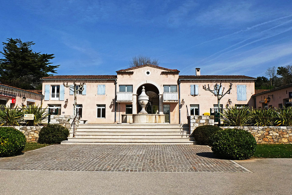
Since the independence of the municipality after the French Revolution, the management of the territory falls to the Mayor and his advisers. It is the first time since the repopulation of the XVIth century that the political authority resides on the constituency which it has in charge. Despite everything, it was necessary to wait until the second half of the 19th century to materialize this new status: the project to build a common house was only launched in 1861 and did not obtain unanimous approval. Indeed, it is planned to build this building near the Notre-Dame de Canlache church. Distance issues reappear for Roquefort residents living in the south of the town. The population remains divided. Moreover, the meeting place of the municipal council is transferred four times, until the final fixing of the place, in 1989, in the current town hall. Likewise, school education sites have generally followed the movements of town halls.
Bourgeois as well as nobles own properties on the territory, often qualified as “bastides”, but do not live there permanently. These are more areas of agricultural exploitation in which farmers are employed, or second homes, the main place of life being in La Colle or Saint-Paul.
This new distribution in hamlets gives birth to microcosms, later qualified as “patèque”, where the inhabitants benefit from a great deal of autonomy. Consequently, the places of life are particularly dispersed over the whole of the Roquefort region, both on both sides of the Miaine and also in the south, thus forming a division between the Upper and Lower Roquefort.
At the beginning of the 18th century, a succession of crises provoked for the inhabitants, as for the communities, a very strong and unbearable fiscal pressure. The war of succession in Spain (1701-1713), the invasion of the Imperials in 1707 in Provence, the great winter of 1709, the policy of buying back feudal-seignorial rights led to an explosion in taxes and municipal debts. Three quarters of the inhabitants live in poverty. Pauperization is general. Saint-Paul, whose treasury was at bay, chose the solution already used in the 13th century by Lérins, to cede its rights to Roquefort. November 15, 1718 is the transfer of all feudal rights with high, medium and low justice of Saint-Paul, to the Alziary, Bellissime, Lombard and Mougins families (the latter ennobled on April 2, 1822): the coseigneury of Roquefort is born out of the Saint-Paul fiscal crisis.
In December 1789, JJ Mougins de Roquefort, mayor of Grasse, deputy of the Third Estate in the States-General, obtained from the Constituent Assembly, the erection of the parish of Roquefort as a separate commune from Saint-Paul, separation operated in February 1790. The April 5, 1790, Roquefort, which then had 590 inhabitants, was separated from Saint-Paul-de-Vence and formed an independent municipality.
Newly independent from Saint-Paul and the four coseigneurs, Roquefort enjoys an unprecedented administrative organization: henceforth, a mayor appointed by the prefect, represents the reference authority, and the first to obtain this function was Honoré Civatte, from Boisnègre district. He maintains a regular correspondence with the prefect and the sub-prefect, attested today by a large quantity of these letters preserved in the funds of the municipal archives.
The nineteenth and early twentieth centuries represent an essential period in the history of the municipality because it sees the launch of important municipal works. In 1861, the first estimates were drawn up relating to the construction of a common house opposite the Notre-Dame de Canlache church. This project does not elicit a unanimous decision from the municipality because of accessibility issues: the inhabitants of the South remain 5 to 6 km away from the common house. Thus, several letters mention the resignation of members of the municipal council, who claim, by this means, their opposition. However, the new town hall was erected in the chosen location, and the first restoration work was even envisaged in 1886.
During this period, the municipality takes to heart to improve the comfort of the inhabitants. The first water supply works are undertaken, and plan to distribute the waters of the Foulon canal. To do so, Roquefort must deal with the municipalities which also benefit from these waters, in particular Rouret and Grasse. Even though drinking water arrived in 1899, agreements were tedious to establish and disputes over water concessions continued until 1940 (at least, in documents in the municipal archives). Even today, water control represents major challenges for Roquefort-les-Pins.
In addition, the maintenance of rural roads becomes a priority for the municipality, which is gradually becoming aware of the richness of these roads. Today, Roquefort-les-Pins has 53 kilometers of paths and is developing a policy of enhancing the paths, in conjunction with the development of cycle paths. Finally, the needs for subsistence and optimization of the public service suppose the opening up of the municipality and the development of communication routes to the large surrounding towns.
Route 2085 (initially Route des Claps), linking Cagnes to Grasse, is the one that required the most material and financial investments. Indeed, it was built between 1910 and 1916, with, in parallel, the construction of the tramway track, inaugurated in 1911. This line thus opened access to Roquefort and served areas that had remained isolated for a long time.
However, several accidents discredited the reliability of this means of transport. The accident of September 17, 1913 at Pont des Vignes resulted in 19 deaths and 39 injuries. Subsequently, several derailments or brake releases frightened users and the line ceased to operate in 1929. From the prehistoric period, the settlement areas were scattered over the whole of Roquefort. The first continuous groupings probably date from the Iron Age, that is to say between -1000 and -300, and finally stabilized in the medieval period. The centers of population are then around the Saint-Pierre church and the Saint-Michel church, until the demographic decline of the 14th and 15th centuries.
In 1932, Roquefort took the name of Roquefort-les-Pins to avoid confusion with homonymous municipalities. Before the town hall became the center of communal life at the end of the 20th century, this role was taken on by the churches. First concentrated, in medieval times, around the churches of Saint-Michel and Saint-Pierre, the population then gathered around the church of Notre-Dame de Canlache. Over time, the geographical distance between the North and the South has become too great and a second center has been created around the sanctuary of the Sacred Heart. Like medieval life, modern life in the 19th and 20th centuries took place on two opposite points of the territory.
It was not until the end of the 20th century and the beginning of the 21st century for the public authorities to concentrate in a single place, the Plan district, thus creating a zone of convergence and identity reunification in Roquefort-les-Pins.
Development
Roquefort-les-Pins is generally located in the middle country, on a limestone plateau between 200 and 300 meters in ascending slope from south to north and punctuated by hills. This geographical context explains a relative micro-climate at the origin of its historical notoriety. The pine forest is predominant and is the charm of the town. The rock is the other element of the landscape. There are a few rivers there including the Miagne, a tributary of the Wolf. The village is cut to the south, from east to west, by an important axis connecting Grasse to Nice which is the M2085 departmental.
A boys ‘school was created in 1800 and a girls’ school in 1865. In 1899, the waters of Foulon arrived in Roquefort and in 1928 began the electrification of the town.
Roquefort-les-Pins can be divided into 4 zones of unequal importance as one approaches the center, i.e. the Plan district where the town hall is located: a forest zone, a sparsely inhabited zone, a moderately inhabited area and a dense area. The dense zone brings together administrative, educational and commercial activities. The majority habitat is the Provencal style detached house.
For more than ten years, the town has pursued a policy of renovating and improving its infrastructure. But also of urban development, on the one hand to respond to demographic growth and, on the other hand, to satisfy a certain quota of social housing. Thus, new neighborhoods have appeared, in particular a “village center” with housing and shops, which until now did not exist. On the other hand, this policy has been impacted for several years by a drop in State allocations.
Culture Heritage
Places and monuments
Roman and Gallo-Roman remains in the Castellas district
Ruins of the castle of Roquefort, witness of a fierce resistance against the supporters of Saint-Paul.
Notre-Dame de Canlache Church: the Notre-Dame-de-Canlache chapel is mentioned in 1351. The current church, which dates from 1690, was extended in 1865.
Former viaduct of Sept-fonts (1913) (tramway circuit that linked Cagnes to Grasse).
Cave of the golden goat: on the way to La Colle is the cave of the golden goat. According to a legend, during a war between the lord of Roquefort and that of Gap, a golden goat with diamond eyes was hidden in this cave. The legend of the golden goat is widespread in Provence and in the Dauphiné.
Events and festivals
The town hosts the Roquefort Auto Moto Rétro as its main event, the unmissable event for vintage cars and motorcycles on the Côte d’Azur. This event is held twice a year, in spring and in autumn.
Jardins en fête (April)
Fête des Voisins (May)
Fête de la Musique (June)
Feast of Saint John (June)
Les Estivales (June-July-August)
Feast of Our Lady of Canlache: feast patronal (end of August / beginning of September)
Blue Week (October)
La Quinzaine de la Mémoire (end of October -11 November)
Christmas festivities (December)
Exhibitions
Throughout the year the cultural center, Le Bon Accueil, “hosts” each month an exhibition of an artist where prestigious names: Peynet, Van Lith, César, Théo Tobiasse, Picasso, Melchiorre, rub shoulders with artists. local, members of the Photo Club or associations of artists from Roquefort.