Denmark is a North Sea country with a long coastline and more than 400 beautiful islands. Although the country with the highest happiness index is not facing an imminent crisis, Denmark is already planning for the future. In the face of many environmental and social problems, such as climate change, sea level rise, and energy crisis, Denmark will inevitably link the solution with the rational use of marine resources.
Denmark was a society based on agriculture and fishing, and Danes still feel closely tied to the land and the water around them. This respect for nature is why Denmark is a pioneer in promoting sustainability. With the looming threat of climate change, Denmark are turning to more environmentally-friendly urban planning solutions.
Copenhagen is a global leader against the climate change, and the city has developed and implemented highly effective sustainable development strategies. In addition to the most well-known complete carbon neutral strategy, the city of Copenhagen has also formulated effective measures to deal with sea level rise. Copenhagen has a richer and more humane environment smart city design, once again guarantees the direction to became the most sustainable city.
Copenhagen’s Lynetteholm artificial island effectively protects the city’s port. In addition to resisting seawater intrusion caused by rising sea levels, the newly built artificial island will relieve the pressure on urban land use and provide a high-end new district for the country’s capital. In addition, Parkipelago is an artificial island connected by prefabricated parts. This movable floating island is designed as a public space, providing green space and tranquility to the city.
North Sea’s Energy Island is a cutting-edge clean energy application case. One of the biggest challenges in the world today in relation to climate change is the growing demand for energy globally. This makes it even more crucial to find sustainable alternatives to fossil energy and there’s an increasing interest in Danish solutions such as wind power technology. Wind energy is well-established in Denmark, now Denmark produces almost twice as much wind energy per capita as the runner-up among industrialised countries in the OECD. Denmark has the position and knowledge to help other countries around the world move faster towards a green transition.
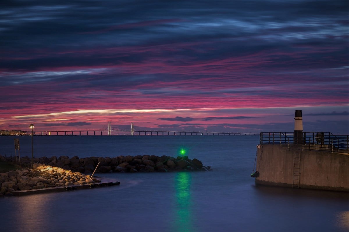
Denmark’s marine engineering is also reflected in infrastructure and transportation, such as the cross-sea bridge project connecting Sweden. Recently, Denmark is working with Norway to develop a series of transportation networks including tunnels for the Faroe Islands, so that these remote islands are more closely connected.
Lynetteholm – artificial islands in Copenhagen to prevent seawater intrusion caused by rising sea levels
The Danish Government and the Municipality of Copenhagen agreed in October 2018 to establish Lynetteholm, a new major island in the Port of Copenhagen. The project aims to help protect against climate change via surge protection, provide a place for surplus soil from construction work, and develop a new district in the city of Copenhagen. For the capital city of Copenhagen, a barrier island with a high-tech dam system promises to mitigate the threat posed by increasingly high and frequent storm surges.
Lynetteholm is an island planned to be established in the Port of Copenhagen to provide climate change protection, place for surplus soil from construction works and, on the longer term, area for urban development. Denmark’s status as one of the world’s lowest-lying nations (its average elevation is just over 100 feet above sea level) has prompted Danish authorities to explore a wide variety of measures to curb the effects of climate change on the country’s landmass, economy and people.
The island Lynetteholm constructed across the entrance to Copenhagen harbour, which makes a storm-surge defences to stop exceptional tidal water flooding into the inner harbour. The island offers depot for surplus soil from construction work, area for urban development. Lynetteholm could also be an opportunity to provide large new parks and foreshore with a careful balance between providing a resource for people in the city and providing new habitat to bring bring nature into the city through well planned and well planted green corridors.
The island will double as a residential and business district housing 35,000 people, that will reduce the pressure in Copenhagen on population development and property prices, and with infrastructural connections to the rest of the city via a metro line, tunnels, and a ring road. Construction will be led by the Copenhagen-based development company By & Havn (City & Port), with initial designs jointly executed by the Danish firms COWI, Arkitema, and Tredje Natur.
Lynetteholm’s total area will be 275 hectares. A green coastal landscape that will contribute to the future northern storm surge protection of Copenhagen is to be created along the east of the peninsula facing out towards Øresund. By & Havn aims to create Lynetteholm by filling inside the perimeter with surplus soil from construction projects in and around Copenhagen, thereby reusing the soil locally for storm surge protection.
Before Lynetteholm can be filled with soil, By & Havn must construct the perimeter, or outside edge of the island. The perimeter primarily consists of large rock dams. The dams are built of sand and rocks that are shipped out and positioned in the water. All work with the rock dams, including excavation work on the seabed, will take place at sea using work barges.
By & Havn is also constructing a 3.6-kilometre new transport road, which accesses Lynetteholm via the Prøvesten industrial area. Construction of the road involves building a dam and bascule bridge at the entrance to Margretheholm Havn and a dam and navigable channel in the Prøvesten Canal next to Copenhagen Motorboat Club.
Lynetteholm’s transport route via Prøvestenen with two dams, a bascule bridge and navigable channel is expected to be completed in early 2023. Lynetteholm’s (perimeter) rock dam system, including the coastal landscape dams, is to be constructed in two phases: The Phase 1 area is the smaller of the two. Construction of the rock dams has already started and is expected to be finished at the beginning of 2023. It will thereafter be filled with soil. The Phase 2 area comprises the larger area. Construction of the rock dams for the area is planned to start in the autumn of 2023, and they are expected to be finished at the beginning of 2026.
After the flood embankment project is completed, the reclamation of the artificial island will continue, and the entire project is expected to be completed in 2050-70.
Parkipelago – floating islands in Copenhagen to provide public spaces
Parkipelago is a project that seeks to introduce parks and public spaces into the city in the form of floating islands. Mobile, floating and free for public use, the Copenhagen Islands concept was created as a way to revitalise the city’s old harbour while introducing green space for the benefit of local residents, flora and fauna. Another reason is to create leisure areas for citizens to enjoy, that can be adapted to rising sea levels, one of the challenges facing Denmark in the coming years.
Designed by the Australian architect Marshall Blecher and the Danish designer Magus Maarbjerg, from the Studio Fokstrot, seeks to introduce a new form of public space in the city. The aim is to give the city’s industrial port area a new lease of life, which has seen considerable development in recent years. The floating islands can be used as a base for swimmers, as spaces to open a bar, a cafe or a sauna or even as mussel farms. The plans for Copenhagen Islands also include the creation of parks, gardens or urban vegetable gardens, which would provide more space for endemic plants, birds, insects, algae and mollusks.
Anchored to the harbor floor, the islands will be made of steel and recycled floating elements clad in sustainable wood approved by the Forest Stewardship Council. The small islands form an archipelago of floating parks, offering a platform for relaxing, fishing or stargazing and accessible by boat, kayak or swimming.
The upper part of the islands will be planted with endemic grasses, bushes and trees, so that guests can be immersed in nature. The lower part of the islands will provide an ideal environment for the algae and shellfish that will stick together, providing the perfect habitat for the fish and other marine life that will gather. The Copenhagen islands will also form a new habitat for wildlife, both above and below the water surface.
The project also aims to create a new resilient urban planning approach, based on recycled and sustainably sourced materials. Each one of the islands is being built by hand in the shipyard of Copenhagen’s port, using traditional wooden boat building techniques. These can move from one area to another, depending on the city’s requirements, and even join together to form a large area that can be used for major events.
In addition, the “Parkipelago” project is constantly expanding, and more islands will be added over the years. The first prototype island that launched in 2018 and was anchored in various parts of the city harbor. Copenhagen Islands launched three more human-made islands in 2020, with more planned in the future.
North Sea’s Energy Island – Harvest clean energy against the energy crisis
The world’s first artificial energy island will be established approximately 100 kilometers out in the Danish part of the North Sea, Energiøen will collect enormous amounts of green energy from ten surrounding offshore wind farms, and via Danish and international connection lines the energy will be distributed to Denmark and Europe. The Energy Island will thus contribute to Europe phasing out fossil fuels more quickly and accelerating the green transition.
Denmark has a long history of utilizing the strong wind at sea for the production of electricity. the world’s first offshore wind farm was built in 1991, and now Denmark is once again at the forefront of a paradigm shift in the green transition with the establishment of the world’s first artificial island, which will supply several countries with renewable energy.
The Energy Island will be an artificially created island, of which the state will own the majority. The island is expected to have a size of at least 120,000 m2, equivalent to 18 football pitches. When the island is expanded, it is expected to have at least an area equivalent to 64 football pitches. The Energy Island bring the strong Danish competences within project development, technology and financing into play and contribute to innovation and green exports.
The energy island will be constructed as an actual artificial island that will collect and distribute the power from surrounding offshore wind farms. The island will initially have a capacity of 3 GW and be able to cover 3 million electricity consumption of European households. In the long term, the capacity must be able to be expanded from 3 to 10 gigawatts, which is enough to supply 10 million households.
The island must also be able to install technology to convert the green power into fuels for ships, planes and trucks. The solution with a dammed island offers the best opportunities to expand the island with e.g. a port and facilities for storing and converting the green power into fuels for planes, ships and trucks.
The energy island is more than just an island, which also can be a hub in the digitization of Northern Europe and attract global tech investments to Denmark. The Energy Island will be a natural hub for this network, and at the same time it will be a source of renewable energy that can ensure power for digitization. In recent years, the Nordic region has become an attractive hub for the transport of data worldwide and home to some of the world’s largest technology companies.
Bridges and tunnels connected the Faroe Islands
The Faroe Islands are 18 islands in the North East Atlantic. Located in the Northeast Atlantic, the Faroe Islands comprise 18 small islands, characterised by steep cliffs, tall mountains, narrow fjords – and a population of 50,000. The beautiful green islands are a self-governing part of the the Danish Realm. Many Faroese fish products are renowned for their quality. Among the Faroe Islands’ other important economic activities are financial services, energy-related businesses, shipping, manufacturing for the maritime sector, IT and telecommunication, tourism and creative industries.
For generations the islands were isolated and self-sustaining, until the emergence of industrial fisheries in the late 1800s led to the Faroe Islands becoming part of the international economy. The Faroe Islands are an archipelago of 18 islands that were shaped by volcanic activity and the glaciers of the ice age. Seventeen of the islands are inhabited, and they are well-connected with paved roads, tunnels, bridges and ferry lines.
The Faroe Islands have one inter-insular bridge, which connects the two biggest islands, Streymoy and Eysturoy. In addition to this, two land bridges connect the island of Borðoy to Kunoy and Viðoy. The islands that are not connected by bridges, land bridges, or underwater tunnels are connected by seven different ferry links, which are run by the nationally owned transport company SSL (Strandfaraskip Landsins). The ferry routes range in duration from 15 minutes to two hours. The longest route is between Tórshavn and the southernmost island, Suðuroy, which has a population of nearly 5000 people. The route is serviced by the biggest domestic ferry, Smyril.
The excellent transportation links between the different areas in the Faroe Islands are of great importance to local businesses and people alike. Paved roads connect all the inhabited villages, and the populated areas are connected by 17 land tunnels. The various islands are connected by two underwater tunnels, in addition to three bridges and seven ferry lines. There are seventeen tunnels on land in the Faroe Islands. The tunnels have drastically improved the accessibility of many key locations by making it possible to drive to regions that had previously been accessible only with boats or by walking over high mountains.
The first tunnel was completed in Suðuroy in 1963 and was 1,450 metres long. Since then, several more tunnels have been built, scattered on seven of the eighteen islands and ranging in length from 220 to 3,240 meters. The most trafficked tunnels have two lanes, but many of the tunnels connecting the more sparsely populated areas are single-laned. The island with the most tunnels is Kalsoy, which despite its small population of approximately 100 people, has a total of five single-laned tunnels.
The turn of the 21st century marked a new era in the history of transportation infrastructure in the Faroe Islands, as it saw the construction of two sophisticated underwater tunnels. The first of these tunnels, Vágatunnilin, opened in 2002. It connects the island with the only airport in the Faroe Islands directly to the mainland, stretching 4,940 metres between the islands of Vágoy and Streymoy. The second underwater tunnel, Norðoyartunnilin, was completed in 2006. It measures 6,186 metres in length and connects the island of Borðoy, which is home of the second largest municipality in the Faroe Islands, to the mainland. Norðoyartunnilin has a fascinating light show by the internationally acknowledged Faroese artist Tróndur Patursson.
In February 2017 the drilling process of the Eysturoy sub-sea tunnel started, marking the start of the biggest infrastructure expansion in Faroese history. The tunnel, which is expected to be completed by 2020, will shorten the travel distance between the two largest islands, Streymoy and Eysturoy, from 55 kilometres to 17 kilometres. The tunnels will shorten the daily commute for several thousand people by up to an hour and a half and thereby strengthen commercial competition and the national economy as a whole. People travelling between Tórshavn, the Faroese capital, and Strendur, a village in Eysturoy where the tunnel will emerge, will save 48 minutes on their journey, which is expected to take only 16 minutes in the future. The drive between Tórshavn and Klaksvík, the second largest city, will be shortened from 68 minutes to 36 minutes.
The Eysturoy sub-sea tunnel will be approximately 11.2 kilometres long and is constructed by the public limited company Eystur- og Sandoyartunlar. An estimated 6000 vehicles will drive through it every day. Eystur- og Sandoyartunlar are also planning to construct the Sandoy tunnel, that will connect the island of Sandoy to Streymoy. Drilling for the Sandoy tunnel will commence when drilling for the Eysturoy tunnel has completed. According to schedule. The tunnel will be 10.6 kilometres long.