The United States of America is called the home country of the automobile; having a quarter of a billion cars on the roads (which amounts to roughly 25% of all cars in the world), more than any other nation. It also has the highest number of cars per capita of any non city-state country. Consequently, car dependent settlement patterns and mass motorization have arguably reached higher, more extreme, levels in the U.S. than anywhere else, and cars have become so pervasive that their ownership is still often assumed as the default. In fact the form of ID most Americans own is usually a driver’s license.
Unlike in most European and East Asian countries, where public transport is seen as an essential public utility, public transport in the U.S. is largely regarded as a social welfare program for those too poor to afford a car. As such, frequencies tend to be bad, and public transit authorities struggle to obtain enough funding even for the most basic maintenance, particularly in areas dominated by the Republican party (who are largely opposed to any government spending on welfare). Moreover, heavy political lobbying from car manufacturers and oil companies also means that any taxpayer dollars designated for transportation are often used to build new roads for more cars rather than improving public transportation. If you decide to take the plunge, you’ll often find decaying infrastructure that makes use of technology that has not been updated for decades, and you may also find that buses and trains are dirtier compared to the rest of the developed world. The Anglosphere in general – and the U.S. in particular – also tend to have higher construction costs for public infrastructure, meaning that when money does become available, they get less “bang for the buck”.
Still, many travelers want to get around without a car, whether for the lack of a driver’s license, to save money, or to minimize environmental footprint. Another reason is that city driving can be quite stressful and many people want to enjoy a relaxing holiday away from even the thought of their annoying daily commute.
For both local and long-distance public transportation in the U.S., detailed information is almost always available online (on individual transit companies’ websites and often on services like Google Maps), making it easy to plan ahead of time.
By train
One popular alternative to car travel are the various forms of urban and intercity rail service. Unfortunately, due to successful political lobbying by car manufacturers and airlines, American rail services suffer from chronic underinvestment and are slower than most counterparts in Europe and East Asia, with intercity services that often run no more than once a day. However, urban rail networks are expanding in many cities and some intercity rail lines have had minor improvements as well. The area best covered by passenger rail services (of all kinds) is generally the Northeast between the cities of Boston and Washington, DC with some urban rail and Amtrak services branching out further with reasonable travel times and frequencies even beyond that area. Another area that is surprisingly well covered both in terms of frequency of trains and number of stops is California. Train service between Oakland and Los Angeles will remain slow until the completion of the high-speed rail link in a few years; nonetheless, the Bay Area is well covered by BART (Bay Area Rapid Transit) and CalTrain, which goes all the way south to Gilroy, and with the extension of the LA Subway and light rail lines (Metro Rail), the notoriously car-centric Los Angeles area is now at least partially accessible without a car. Current trends indicate that local and regional train coverage will only get better in the future, with several local and statewide rail improvements either scheduled for construction or being built right now.
Another important hub for rail travel is Chicago, with many Amtrak lines terminating there or going through the city. If you are traveling by train from coast to coast, chances are you will pass through Chicago. However, few lines have top speeds significantly higher than 79 mph (127 km/h), even though some upgrades are planned or underway. In addition to that, Chicago has a functioning and well patronized urban rail system. Still, some of the most popular tourist destinations in the U.S. cannot be reached by train alone. Neither Las Vegas nor the Yellowstone National Park gets any regular train service. Amtrak serves 46 states, i.e. all with the exception of Hawaii (urban rail under construction on Oahu), Alaska (served by the Alaska Railroad, see below), South Dakota and Wyoming (both states entirely without passenger trains). Even in some of the states it does “serve”, the biggest city or metro area is not served by Amtrak. Idaho for example only sees one route passing through the panhandle in the extreme north of the state, while missing the major population centers.
If you want to combine bike and rail, Amtrak offers you to carry your bike. See their regulations on special items for details. See also here.
Alaska is not served by Amtrak but does have train service through the Alaska Railroad, which mainly serves a corridor between Seward and Fairbanks via Anchorage. Outside of that corridor, Alaska is fairly inaccessible by rail. However, this is also true to a degree for cars. For example, the capital, Juneau, cannot be reached by other means than sea and air. As a matter of fact, some of the places served by the Alaska railroad are not connected to any road and hence the train is the only practicable way to get there.
Heritage railways exist throughout the U.S. and in some places they do provide some transportation value, with some serving a station Amtrak also serves and coordinating their schedule with Amtrak. In other places tourist railways or dinner trains are mostly employed for their novelty value and don’t offer transportation beyond short round trips or circular tours.
The largest cities are often served by one or several urban rail systems. In some cases they are the best way for getting around a city. Some of them, like the cable cars of San Francisco or the L of Chicago, are iconic for the city and double as attractions.
By bus
Intercity
While there are in fact places that see Amtrak service but none through the main intercity bus companies, overall bus coverage is better as some sort of intercity bus operates in all 50 states (whereas Amtrak only covers 46). There is a wide range of quality and price but generally you will have lower prices than on Amtrak for most trips (in the Northeast Corridor dramatically so) in exchange for a bit less legroom and less ability to walk around during trips or get food on the moving bus. Many bus companies are still or have historically been associated with immigrant communities (like the fabled Chinatown-buses or the newer Mexican-American buses) and are still mostly patronized by them. While intercity bus stops can be in all parts of town and they are often downtown as well, some are in somewhat problematic neighborhoods. Usually our city-guides mention that and if that is the case, try to avoid late night arrivals or departures.
Local
While the coverage by local buses is by no means universal, most populated places in the U.S. have at least token bus service with varying degrees of actual usefulness. Unfortunately they are not always clearly labeled in system maps, unlike most urban rail systems. Getting around by bus within a metro area thus often requires asking around or using one of the newer transportation apps. Night service while becoming slightly more common over time is still the exception rather than the rule and even in major cities you may find yourself “stranded”. City buses usually operate on a system of paying your fare to the driver in exact change. A few cities have upgraded some bus lines to “proof of payment” systems or other forms of off-board fare collection which require paying before boarding the bus and usually enable significantly faster trip times.
Environmental impact
The environmental impact of buses is lower than that of even the fullest airplanes; however, comparisons to trains and in some cases even cars are much harder to make. If one assumes the average occupancy to be nine people (as is assumed for city buses) even a car with an average of 1.2 people in it starts to become competitive in terms of passenger miles per gallon. However if one assumes yield managed intercity buses on busy routes with 80% or more occupancy, even Amtrak cannot compete in terms of fuel efficiency per passenger. As Amtrak only runs electrified routes in the Northeast, the question of how the electricity is generated is less important than in other countries, but as the Northeast still mostly depends on fossil fuels, electricity is not necessarily much “cleaner” than gasoline. In cities where urban rail exists, it beats buses hands down in terms of efficiency, not only because of higher occupancy but also because urban rail almost always runs on electricity and feeds part of the braking energy back into the grid.
By plane
Perhaps not very environmentally friendly, but flying is — at least for long distances — a fast and practical way from place to place. Also many smaller communities can be reached by plane. For more information, consult the article on air travel in the United States. In most major US cities there is a dedicated urban rail service or at least an express bus service connecting the airport to the city center. This is often even true for cities with otherwise virtually non-existent public transit.
By boat
The U.S. has a large system of inland waterways. And cruising the Erie Canal, the mighty Mississippi River or myriad other natural and man-made waterways is a great way to get around as well as an attraction in itself. In addition, the Alaska Marine Highway System connects Bellingham (Washington) with communities along Alaska’s southern coast. Also, much of off-the-beaten-path-Alaska can only be accessed by boat.
Unlike much of Europe, sea-ferries play a very small role and there is no way to get to Hawaii except by cruise ship or plane, unless you own or rent a private vessel. Even between the individual islands of Hawaii there is only scant service, one connecting Maui and Molokai and the other serving Maui and Lana’i.
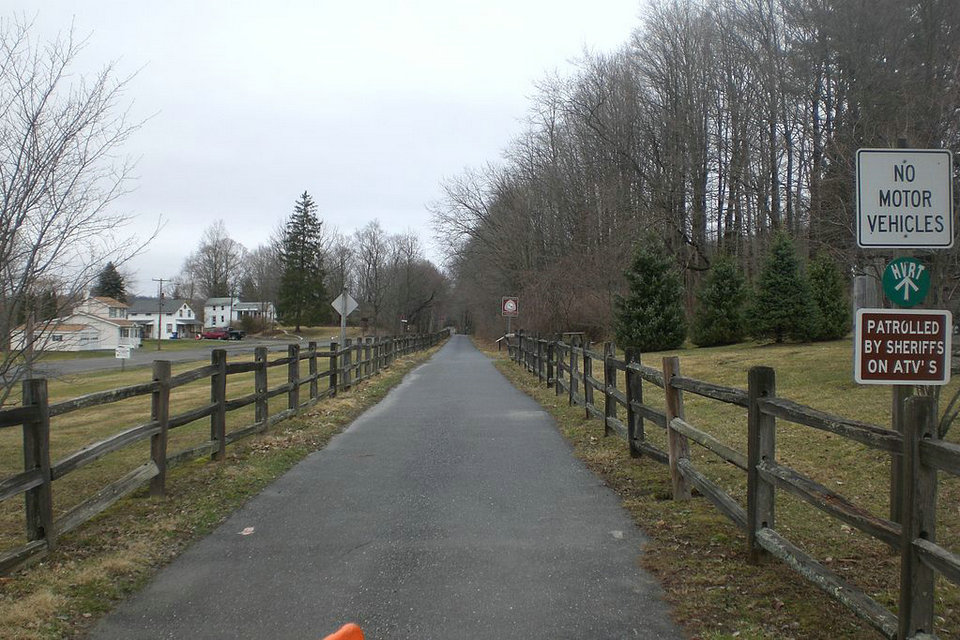
By bicycle
Some U.S. cities have bike-sharing services. However, the presence of dedicated bike lanes is inconsistent between and even within cities. Good cities for cycling include Portland (Oregon), Chicago, Denver, and Minneapolis/St. Paul.
On foot
Some American cities, particularly those which were already highly developed before World War II and therefore designed to be walkable, have downtown areas and some other neighborhoods that are good for walking. Among these are New York City, Washington, D.C., Philadelphia, Chicago, Boston, San Francisco, Seattle and Denver.
For the truly dedicated there are a number of (very) long distance hiking trails like the Appalachian trail or the Continental divide trail. However, there are stretches along those trails that are several day’s marches from the next human settlement and as such we advise you to carefully plan your trip and read our articles on these trails carefully.
Good cities
Austin – while it is served by Amtrak and the main intercity bus operators and is a very walkable and bike friendly city (if you can stand the heat), its public transport is only so-so.
Boston – being built largely in the pre-car-era and containing one of the U.S.’s largest student populations, Boston is rather walkable and accessible by public transit.
Chicago – In addition to being well covered by transit buses and urban rail, Chicago is also a major Amtrak hub with trains leaving and arriving from all directions. Furthermore, it has an emerging cyclist culture with once monthly “critical mass” rides, so getting around by bike is easier than in most other US cities.
Denver – Has good sidewalks for pedestrians, a strong cycling culture, an excellent public bus system that runs late, a free shuttle bus on 16th St. in LoDo (Lower Downtown) and a light rail system that connects LoDo with the outskirts and suburbs. Union Station is a hub for local transit and the airport is also connected to the light rail system.
Minneapolis – Light Rail, Bus and Bike lanes throughout the city provide this city with routes all throughout. The Light Rail goes from the airport to Downtown Minneapolis and onto Downtown St. Paul as well. Other areas of the city are easily accessible by bus. The downtown and uptown areas of both the Twin Cities are very walkable and future light rail routes are planned in future years.
New Orleans – The Big Easy has always been a rather walkable town and its most notable sights are almost all downtown or close to it and thus still best reached on foot. New Orleans was also one of the last cities to retain its streetcars prior to the reemergence of that form of transport in North America in more recent times.
New York City – There is hardly a place in New York that cannot be gotten to by bus, subway, ferry or foot, and most residents, especially in Manhattan, choose to forgo a car.
Philadelphia – Nearly all of the City of Philadelphia is accessible by some form of public transit (if not always especially frequent transit) and regional rail, trolley, and bus lines also serve some of Philadelphia’s older (and, to be frank, more interesting) suburbs. After New Yorkers and perhaps Washingtonians, Philadelphians are the Americans most likely not to have a car or to only have it as a reserve vehicle rather than a primary means of getting around.
Portland (Oregon) – calls itself the bicycle capital of America and is rather well covered by public transport as well
Salt Lake City – believe it or not, this city is actually well served by light rail and a comprehensive bus system
San Francisco – whether it be the historic cable cars or the more modern modes of public transit, San Francisco has long been known as a city accessible without a car, which is aided by its demographics and the lifestyle choices of many of its inhabitants. Bay area public transit consists of several overlapping and sometimes confusing services
Seattle – Another city in the U.S. that can be doable without a car with frequent and often overlapping bus services from downtown to the adjacent neighborhoods. Even if staying near the airport (14 mi south of downtown) there is a frequent light rail from the airport into downtown to allow visitors to “commute” into downtown and its adjacent neighborhoods for a day/evening of sightseeing, shopping, dining and bar hopping.
Washington, D.C. — The national capital boasts an extensive and well-functioning subway network of six lines and is characterized as a walking and biking town. An extensive bike-share system makes getting around even easier.
Difficult cities
Atlanta – outside a rather small downtown core public transport coverage is few and far between which is at least in part due to the city’s rather sprawling nature
Dallas-Fort Worth Metroplex – especially in the areas outside the Dallas and Ft Worth proper and in between the twin cities, surrounding the Dallas-Ft Worth Airport.
Detroit – obviously, the capital of the automotive industry is very car-dependent. In a limited section of the downtown core, the People Mover and the Q line can be used to quickly navigate the area on rail. However the cycling community is on the rise, in part owing to now hugely overbuilt road infrastructure giving space for bikes and cyclists taking it.
Las Vegas – the Strip and the intersecting streets are in suburban Paradise and Winchester. Those streets are, especially during the weekends, nothing but a huge parking lot. Even as the sidewalks are quite crowded, walking is at least comparatively a good way of getting around. In addition, there is also the Monorail running parallel to the Strip (but impractically “behind” the casinos). Almost everywhere else in the city is accessible by bus, though some lines may run as infrequently as once an hour. Unfortunately, there is no Light Rail connecting the suburban areas with Downtown Las Vegas. Even worse, Las Vegas is one of the largest American cities with no railway connection – it was abandoned in 1997.
Los Angeles – although it has been getting better (and will likely continue to do so), L.A. is still a major example of sprawl. Local bus services have improved and are improving but because of the sprawl it would still take longer to get around by bus over long distances. L.A. has also built over 100 mi (160 km) of urban rail since 1990. Light rail is expanding and a good option for the places which it serves, but there are still many areas not served by it. In 2016 L.A. ended over half a century of disconnection from the Pacific when a line linking downtown to the ocean opened to much fanfare and global media coverage, although the line in question actually stops short of the coastline. Still, a visit to L.A. without a car is possible if your destinations are served by light rail or frequent buses. The situation can be expected to markedly improve as a 2016 referendum to further expand Metro Rail services through the coming two decades succeeded adding local funding and certainty on top of existing ballot measures to fund transit. Given that all new taxes in California have to pass with a two thirds majority, this was no small feat and shows the political consensus behind rail expansion in the area. The city will also host the 2028 Summer Olympics which will mean a big boost to the public transit system. There’s also the ambitious “28 by 28” program of 28 transportation projects – including highways public transit and bike infrastructure – that promises to accelerate construction or build new projects before the 2028 Olympics.
Houston – the infamously sprawling oil city that nevertheless has public transit in the form of buses and a light rail system.
Phoenix – the biggest city not served by Amtrak and probably one of the worst offenders in terms of car dependent sprawl.
The suburban cities/municipalities surrounding the “Good Cities” (listed above) 10-60 miles (16-100 km) out of the downtown core of the “Good Cities” can rival the “Difficult Cities” as well. So if you’re staying in the surrounding suburbs or exurbs it may be worthwhile to consider a car if possible. If you want to forego a car, try to avoid suburban and exurban areas.
Popular non-city destinations
Of course, rural destinations are often more challenging to get to than cities. As a matter of fact, most World Heritage Sites in the USA are national parks or otherwise rural, and only about half of them can be reached without driving. Natural attractions within a few hours drive from a nearby major city can often be accessed on a tour. For instance, from Las Vegas, there are tours to many nearby national parks. On the downside, your schedule and destinations within the expansive park will most certainly be set by the tour company. Furthermore many places that tours go to can feel a bit “over grazed”. Consider taking a bus and biking or walking around yourself if possible to get to more out of the way places.
Otherwise your car-free options would be on foot or by bike, but this should be considered as an experience in itself rather than just a necessary way of getting in. Namely, especially in the western two thirds of the country, don’t expect the next bus stop or train station to be a three-hour stroll away like often is the case in Europe.
The Adirondacks are accessible via the (aptly named) Amtrak Adirondack and some other points can be reached either by heritage railroads or buses and on the navigable bodies of water you can of course cruise in small craft, but other than that you would have to rely on sturdy boots and firm legs to get around.
Cahokia Mounds State Historic Site is less than a mile from a local bus stop, served by buses between East St. Louis and Collinsville (Illinois).
Denali National Park in the Alaskan Interior is surprisingly accessible without a car; there’s passenger rail service to the town of Denali right next to the park and there are shuttle buses taking visitors around the park.
Disneyland is served by several local bus lines.
Hawaii Volcanoes National Park is accessible by bus from Hilo with five buses a day except Sundays.
Glacier Bay National Park is entered from the adjacient town of Gustavus, which in turn has an airport and a harbor where ships on the Alaska Maritime Highway dock, both a little over a mile from Gustavus. Visitors usually get around the park onboard some kind of watercraft; kayak, cruise ship, tour vessel or rental boat.
Glacier National Park is one of the easiest national parks to get to by train. Not only does the Empire Builder travel right next to the park for some distance, there are also two stations on the line directly serving the park; West Glacier and East Glacier. There are some bus services for getting around the park.
Grand Canyon Village is accessible by a shuttle service from Flagstaff train station. Another option is taking the train to Williams and the Grand Canyon Railroad (a tourist railway) from there to the rim of the Canyon.
Niagara Falls can easily be visited by train. Amtrak’s Empire Service and Maple Leaf take you directly into the city. Alternatively, local bus service is convenient and frequent from Downtown Buffalo’s bus terminal, complete with connections to the Buffalo Niagara International Airport.
Olympic National Park is another excellent place to visit without a car, matter of fact it’s described as one of the last roadless patches in the lower 48 states and as such a hiker’s paradise. A sliver of the park reaches into the town of Port Angeles, about 5 miles (as the crow flies) north of the main portion of the park. Port Angeles has bus connections from Seattle, SeaTac Airport and other towns in the region, and a ferry connection from Victoria in Canada.
Redwood National Park can be reached by local bus lines operated by Redwood Coast Transit, connecting from nearby cities like Crescent City and Arcata. Both have a regional airport, and Arcata has a bus station served by both Greyhound and the Amtrak Thruway Motor Coach (connecting to trains in Martinez).
Walt Disney World can be reached by public bus from Orlando and Kissimmee.
West Yellowstone at the western entrance of Yellowstone National Park has an airport (in Jackson Hole, Wyoming) with flights during the summer months. During the summer there’s also a bus service running in the park. There is no Amtrak service throughout the entire state of Wyoming.
Yosemite National Park is accessible by buses meeting Amtrak’s trains in Merced and Yarts Bus.