Archaeological Illustration is a form of technical illustration that records material derived from an archaeological context graphically.
The use of archaeological illustrations began early. Special artefacts have a rich development history as an indispensable element in the time before photography, but today they also play a major part.
Archaeological Illustration encompasses a number of sub disciplines. These are:
Surveying: To produce an accurate record of sites and buildings and to record accurately where the sites and buildings lie within the landscape. Surveyors use a range of equipment including tapes, plane tables, total stations, 3D scanners, GPS and GIS to produce illustrations including plans, sections and elevations as well as isometric and axonometric illustrations which are regularly used in building recording. Survey data will be gathered on acid free paper, polyvinyl permatrace and archive stable digital formats.
Photography: To produce a record of archaeological sites, buildings, artifacts and landscapes. Archaeological photographers will uses a range of different formats particularly black-and-white and colour slide. Digital photography is now starting to become more widely used and is especially useful for the recording of historic building. Aerial photography is commonly used as a tool for recording sites and is also used as a prospecting tool to locate new archaeological sites.
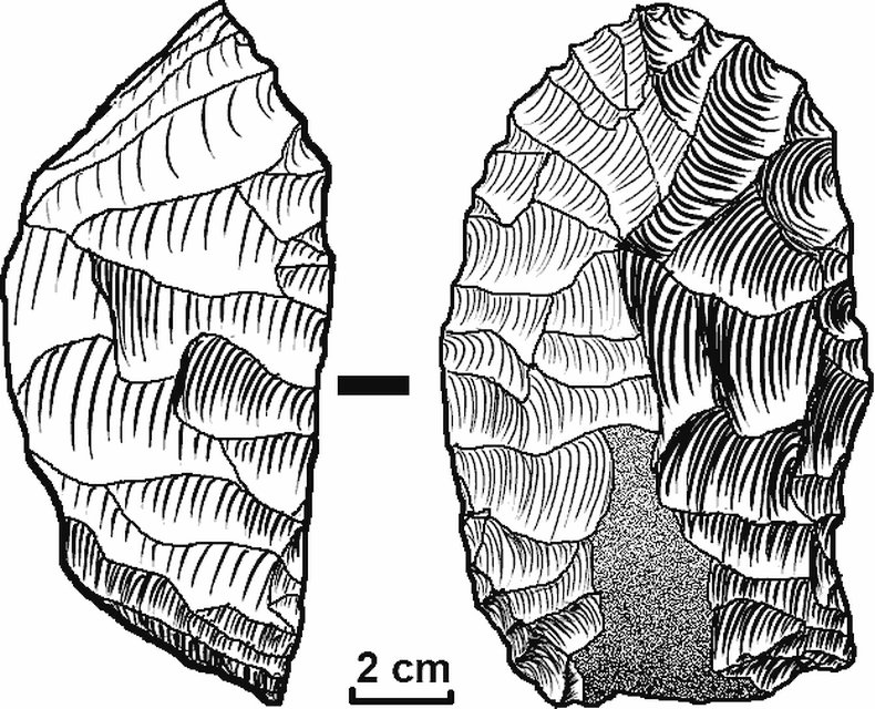
Artefact illustration: To record objects using agreed conventions to allow further study of the objects by specialists on publication.[4] Artefact illustrators will use pen-and-ink as well as graphics and page layout software.
Interpretation and reconstruction illustration: To visualise the results of archaeological field work in a way that is meaningful and visually appealing to as many as possible. Reconstruction artists work in many media from traditional pen-and-ink and painted reconstruction to more modern techniques including 3D, virtual reality and video.
Examples of Understanding and Reform: This is done to show the archeological field of work in a more understandable and visually appealing manner. Reformers work from conventional pens, daggers and painted reforms to 3D, virtual reality, and modern media.
In Denmark, Jon Skonvig delivered drawings in the 1600s to Ole Worm’s work Monumenta Danica. His drawings of, for example, the jelling stones bear the impression that he has failed to reproduce the motives exactly. Far more precise drawings provided Søren Abildgaard in the 1700s, but naturalistic detailed drawings came first until the 1800s. Here excellent people like Jacob Kornerup, Julius Magnus-Petersen and A.P. Madsen arose as archaeology as science evolved and several oversight works with representations of ancient monuments and archaeological objects were published.
Interpretation and reconstruction illustration: To visualise the results of archaeological field work in a way that is meaningful and visually appealing to as many as possible. Reconstruction artists work in many media from traditional pen-and-ink and painted reconstruction to more modern techniques including 3D, virtual reality and video.
Source From Wikipedia